
Stone from the Shore: Pictou Island’s Grindstone Industry
A little-known island industry
During the nineteenth century, the sandstone shores of Pictou Island supplied stone for grindstones: the circular abrasive wheels used to sharpen tools and work metal. Although the island is often remembered for its farming, fishing, lighthouse and lobster factories, stone quarrying was another part of its working landscape. It connected the island to a wider industry operating around Pictou and Merigomish harbours and elsewhere in the Maritimes.
Why this stone mattered
A grindstone was not simply any rounded stone. Its sandstone needed grains that could abrade metal and gradually wear away to expose fresh cutting surfaces. In an account preserved by the Tantramar Heritage Trust, Herbert William Read of the Read grindstone business described how different quarries produced stones with different properties. He characterized the Pictou County stone as comparatively soft, useful for particular sharpening and metal-finishing jobs, including pocket knives and some fine tools.
Grindstones ranged from small wheels turned by hand to large industrial stones. The Read family account describes the use of picks, hand drills, stone chisels, tackle and horses, with schooners carrying stones to markets. A later study of the company’s original Rockport ledger documents specialized “Joggins Boats” used for moving heavy stone in the Bay of Fundy industry, and reproduces an 1866 boat inventory. These methods illustrate the regional trade, not proven Pictou Island practice: the equipment, on-Island finishing facilities and loading arrangements remain unverified.
Quarries along the island’s shores
Freestone quarrying is documented on Pictou Island in an 1843 British sailing directory. John Purdy and Alexander G. Findlay's The British American Navigator reports that freestone quarries had already been opened on the Island. Edmund Blunt's American Coast Pilot repeated a comparable description in 1847. These are early published accounts of stone extraction, but freestone also served as building stone; neither establishes commercial grindstone production at a named site, the date of first excavation, or the identity of an operator. Later regional industrial history associates quarries on the Island's southwest and eastern shores with the Read–Seaman trading network, broadly in the mid-nineteenth century. Read family testimony also describes buying grindstones from independent producers, so the firm's business connection cannot alone prove ownership of every quarry. The individual Island operators and property rights remain unresolved.
Pictou Island was re-granted to Rear-Admiral Sir Alexander Forrester Inglis Cochrane in 1809 under conditions requiring improvement of the property. A scholarly study of contemporary October 1809 records places Cochrane in the Pictou area around the time of the Island survey and grant; it does not establish that he went ashore on the Island. George Patterson's 1877 history later reported that Cochrane sent William Cumming as an agent in 1814 to settle the Island. Allison Mitcham attributed a role in opening stone quarries to Cochrane, but no original estate account, quarry lease or labour instruction yet connects him or his agents to identifiable workings. The 1843 published quarry notice postdates Cochrane's death in 1832, leaving it unresolved whether the first quarries were opened during his lifetime or by later proprietors.
A more immediate record comes from geologist Alexander Howard MacKay, who examined Pictou Island in August 1890 and published his findings in 1891. In the section beginning at Lighthouse Point, he recorded sandstone beds that had previously been quarried, noting the lack of a convenient shipping place (p. 79). Elsewhere near a public wharf, he specifically recorded former grindstone quarrying (p. 83). He described the latter beds as gray sandstone with rusty-weathering layers and fossilized plant material, including mineralized wood. The geological observations are distinctive, but the workings have not been tied to the eroded quarry east of Bob’s Hollow. Government reports date the federal East Wharf near the centre of the south shore to 1882–83, with later extensions. MacKay visited after that wharf existed, but his reference to quarrying near a wharf does not establish which wharf he meant, or when the quarry operated.
Stone, ships and markets
Pictou Island’s quarrying belonged to a Maritime trade in natural grindstones for farms, workshops and manufacturers. The Read family account describes schooners collecting stones from coastal producers and distributing them through markets that included New England. A more precise example from the surrounding trade appears in a modern transcription of The Enterprise (New Glasgow), November 24, 1888: the schooner Gondola reportedly cleared Pictou for Boston on November 20 with grindstones supplied by R. McNeil at Merigomish and R. E. Chambers at Granton. The original newspaper issue remains to be inspected, and neither supplier’s portion is attributed to Pictou Island. This illustrates the regional export network, not a measured Island shipment. We do not yet know how many stones the Island produced, where they were loaded, or the destination of a particular Island cargo.
A changing shoreline
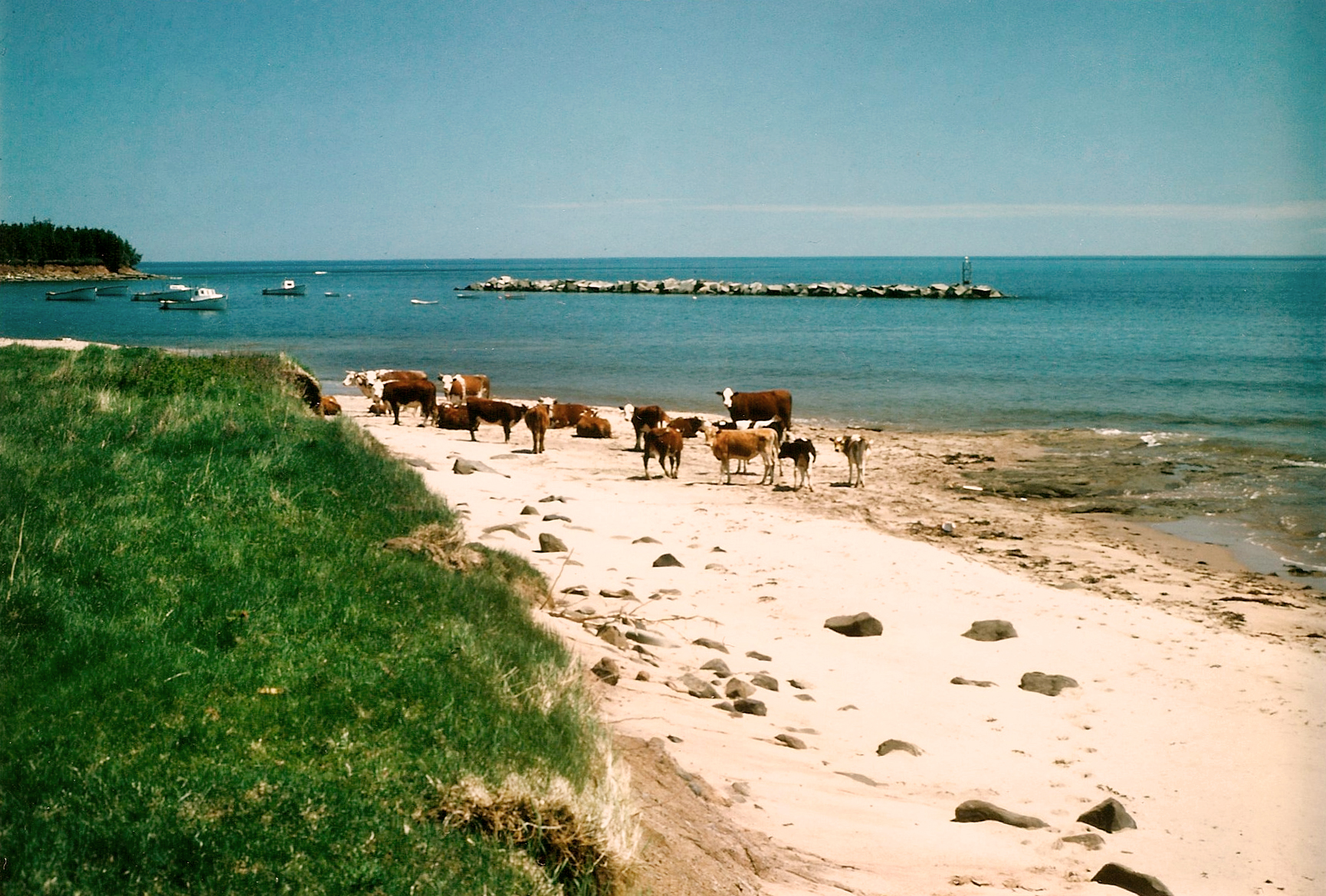
The sites of former shore industries can be difficult to recognize today. Nineteenth-century historian George Patterson reported substantial erosion around Pictou Island. Local knowledge recorded by PIHS places a former shoreline quarry east of Bob’s Hollow, between Bob’s Hollow and the lighthouse. Continuing farther east brings one toward the lighthouse. The former quarry is remembered as having disappeared through shoreline erosion. This eastward sequence locates it broadly between Bob’s Hollow and the lighthouse, but does not establish the position of its original workings.
PIHS preserves Ron MacDonald’s recollection of a wharf at the foot of Bob’s Hollow. Moving east from the Hollow, the remembered former quarry was between Bob’s Hollow and the lighthouse; the lighthouse lies still farther east. This places the quarry and the lighthouse in a definite west-to-east order, rather than making them one place. MacKay’s 1891 geological description also mentions grindstone quarrying near a public wharf, but it has not been shown that his quarry, Ron’s quarry, or the remembered wharf were identical. Precise quarry and wharf footprints remain unverified.
What remains to be learned
The record still has important gaps. No reliable list of the Island’s quarry workers, original quarry-specific leases or shipment figures has been established, and the closing date of the last Island working remains unknown. Two grindstones are reported to survive on Pictou Island today; their photographs have not yet been inspected, and neither has a documented quarry provenance. Further study of period maps, deeds, company ledgers, port accounts and locally preserved objects may clarify the history.
The island's quarrying belonged to a regional industry that changed markedly during the nineteenth century. In a family history dictated in 1971, Herbert W. Read recalled Pictou Island as a producing community but did not include it among the operations he identified as continuing around 1900. This suggests, without conclusively proving, that the Island's commercial grindstone period had ended before the twentieth century. The surviving geological observations, historical records, local shoreline memories and reported grindstones make it possible to recover this overlooked part of the Island's working life, even though the precise operators, closing dates and export quantities remain unknown.
Sources and further reading
- A.H. MacKay, “Pictou Island” (1891), pp.76–83 ↗
- Purdy and Findlay, The British American Navigator (1843) ↗
- Herbert W. Read, family testimony (1971), published in The White Fence (1999) ↗
- George Patterson, A History of the County of Pictou (1877) ↗
Shoreline recollections are attributed to Ron MacDonald. Quarry footprints, operators, production totals and illustration provenance remain unresolved.
Reading the historical map
MacKay’s report follows fieldwork with Hugh Fletcher in August 1890. Its accompanying Plate I, drawn after Fletcher at one inch to a mile, marks two lobster factories and two wharves. These are historical map labels, not cadastral boundaries. The map alone does not identify which wharf adjoined the grindstone beds described on page 83, or establish a quarry operator, production total or modern footprint.
A. H. MacKay, Pictou Island (1891), pp. 76–83 and Plate I. The two reported surviving grindstones still require individual provenance and permitted photographs.