Explore Island lighthouses, cemeteries, the church and other heritage places through photographs and stories. Original PIHS interpretive panels are available alongside their histories.
Heritage Centre and IceboatOpen history, photographs and sources
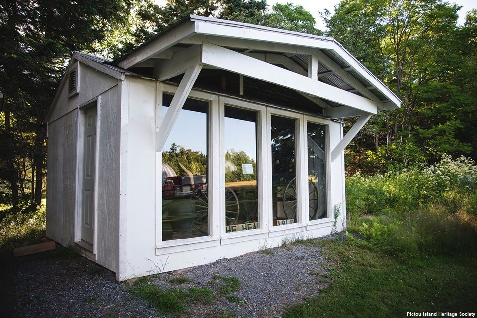
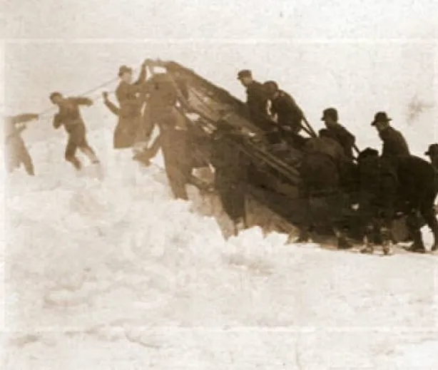
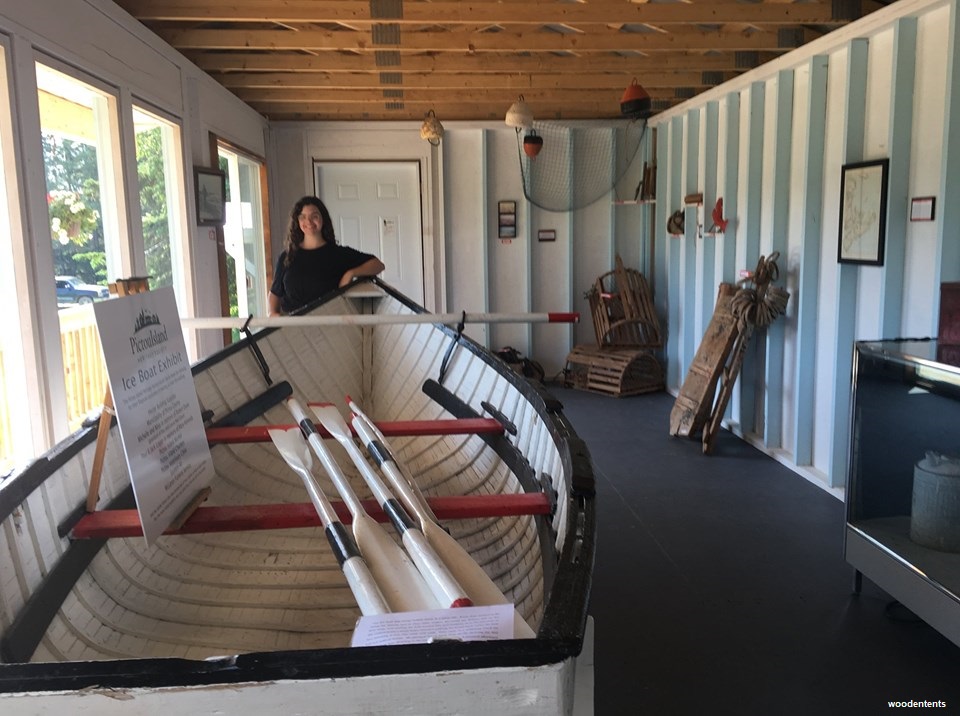
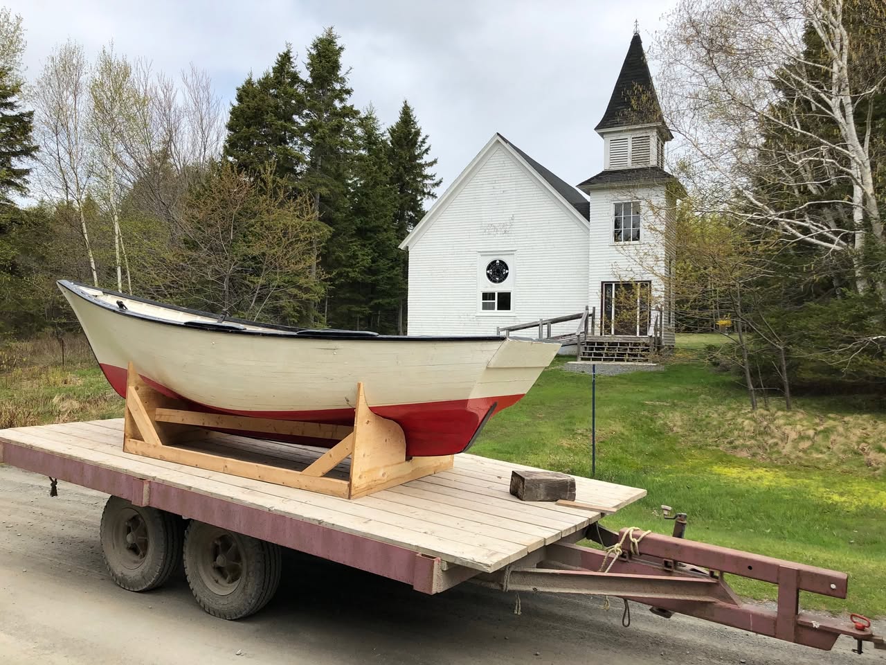
The Heritage Centre houses Island photographs, documents, artifacts and exhibits. Its preserved iceboat recalls the difficult winter crossings between the Island and the mainland. PIHS continues to care for the building and its collections.
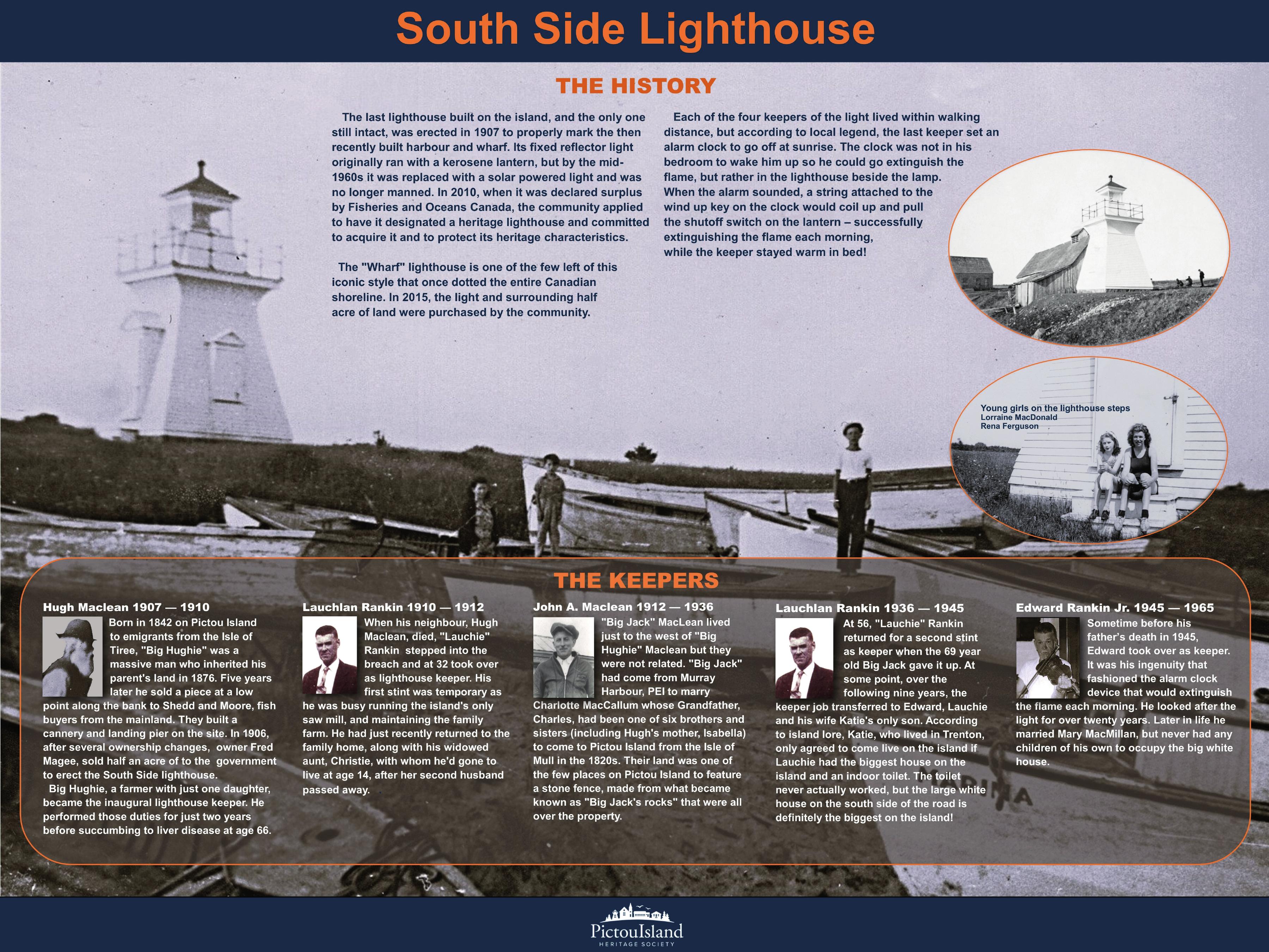
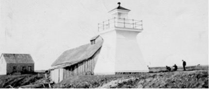
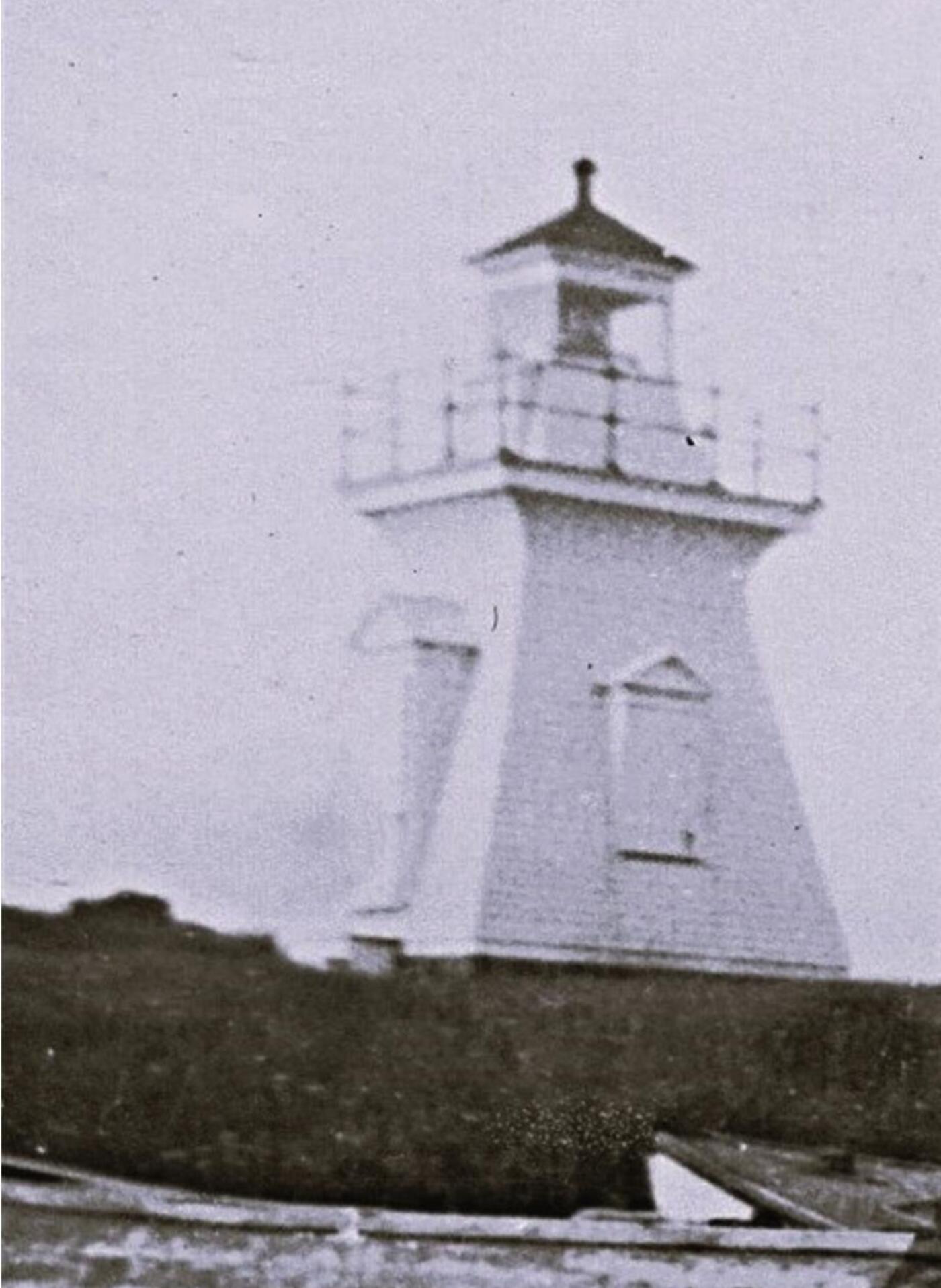
The South, or Wharf, Lighthouse is the Island's only remaining lighthouse tower. Its navigational light was discontinued in July 2026. Explore its history of navigation, fishing, keeper families and traffic to the Island wharf.
West LighthouseOpen history, photographs and sources
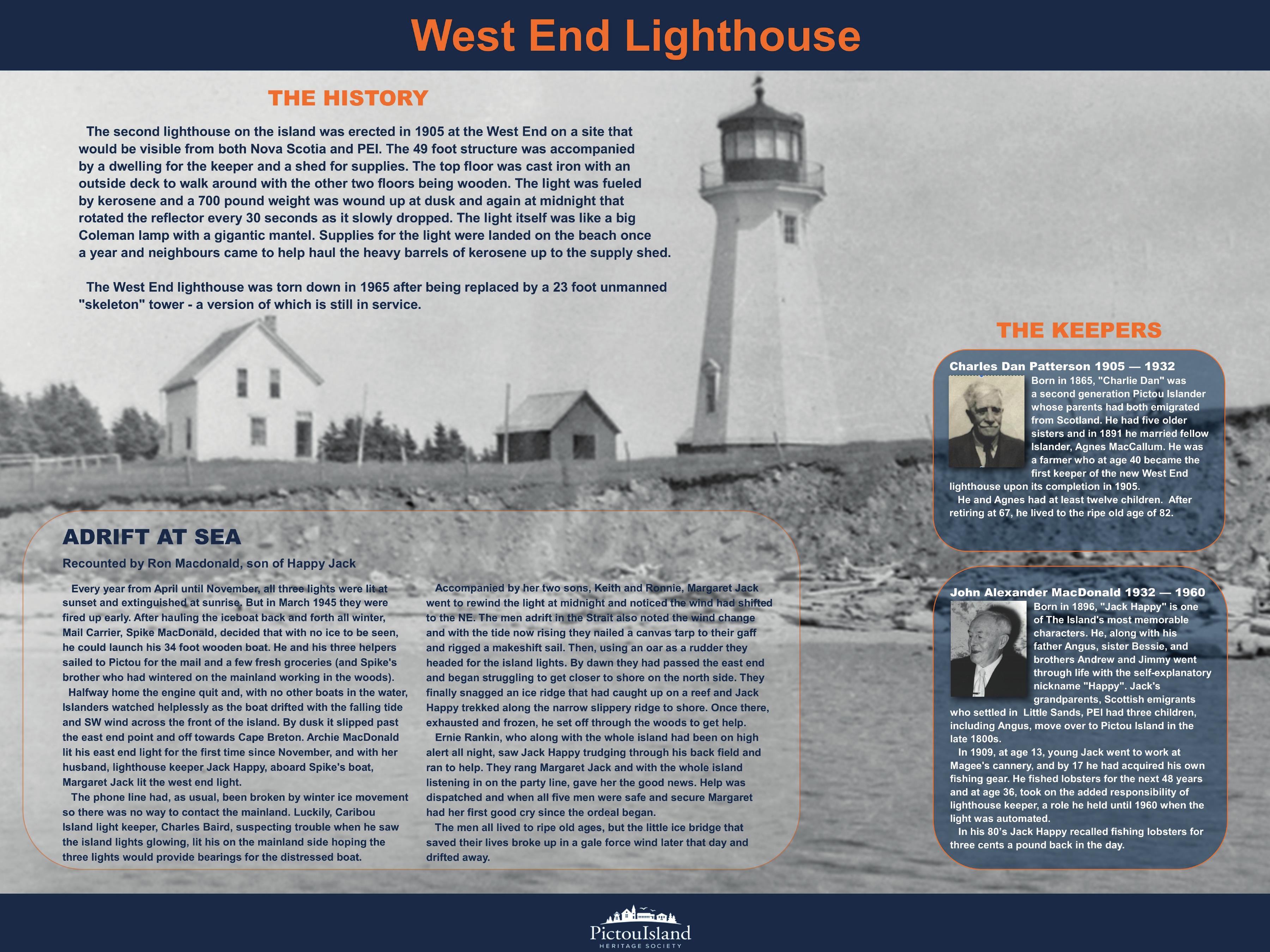
West Lighthouse
Built in 1905, the West Lighthouse included a keeper's dwelling and a rotating kerosene reflector. It was later replaced by an unmanned tower and no longer stands. Ron MacDonald and Jeff Rankin recall a cove around the bend to the north known as Herring Cove, where a shallow reef could concentrate herring.
East LighthouseOpen history, photographs and sources
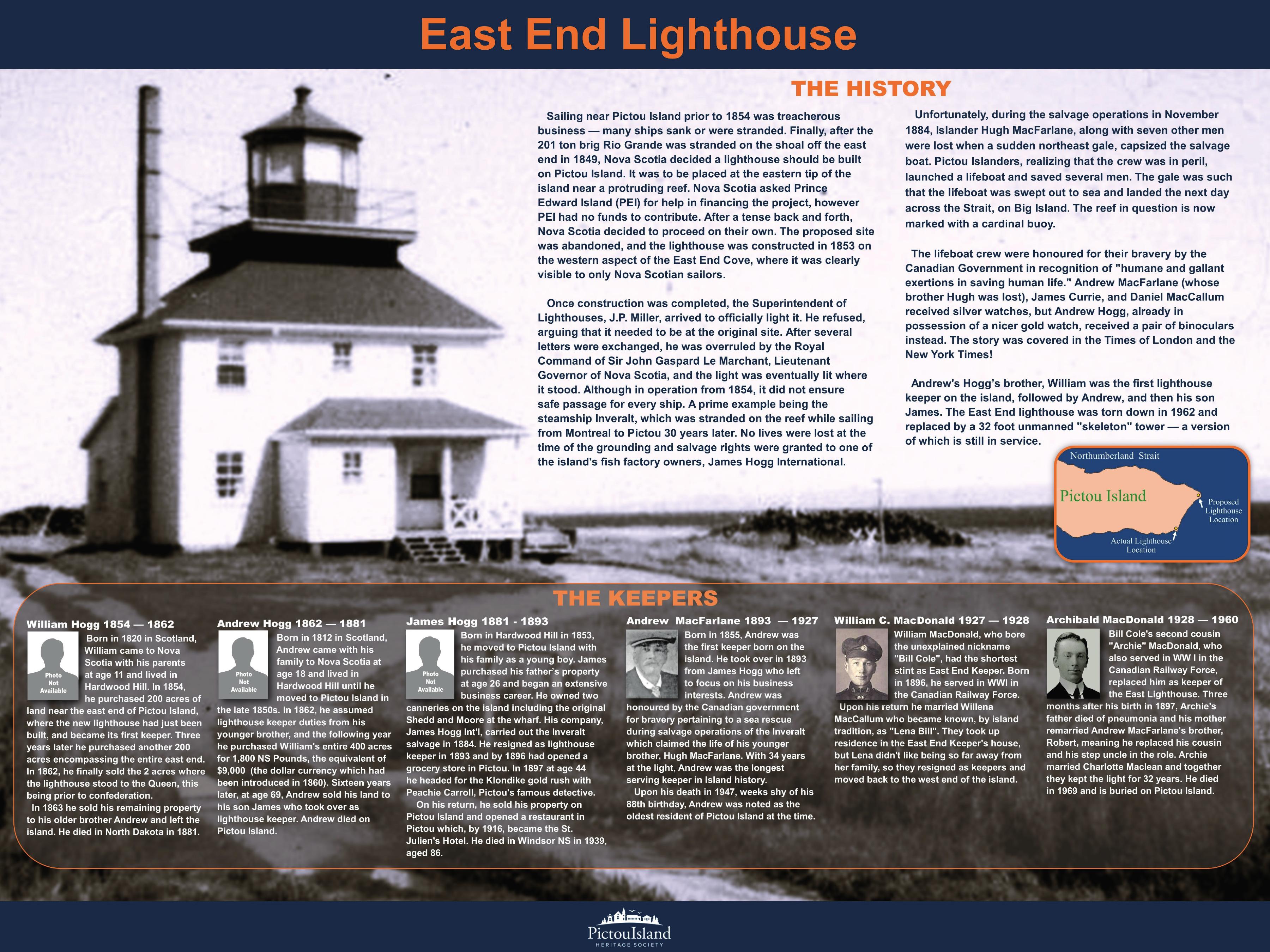
East Lighthouse
The East Lighthouse was established in 1853 and is reported to have begun shining in 1854. A new two-storey lighthouse and keeper's dwelling replaced it in 1930.
The church remains a central community landmark and a place where worship, concerts, meetings, and island memories meet.
Formal opening and dedication took place on 14 October 1910. A preparatory communion service followed on 15 October, before the first Sunday services on 16 October, with Gaelic and English worship, communion and baptism.
Children attended school on the Island by 1872, and a schoolhouse was built in 1884. The later schoolhouse also served as a community centre and remains part of the Island's educational and social history.
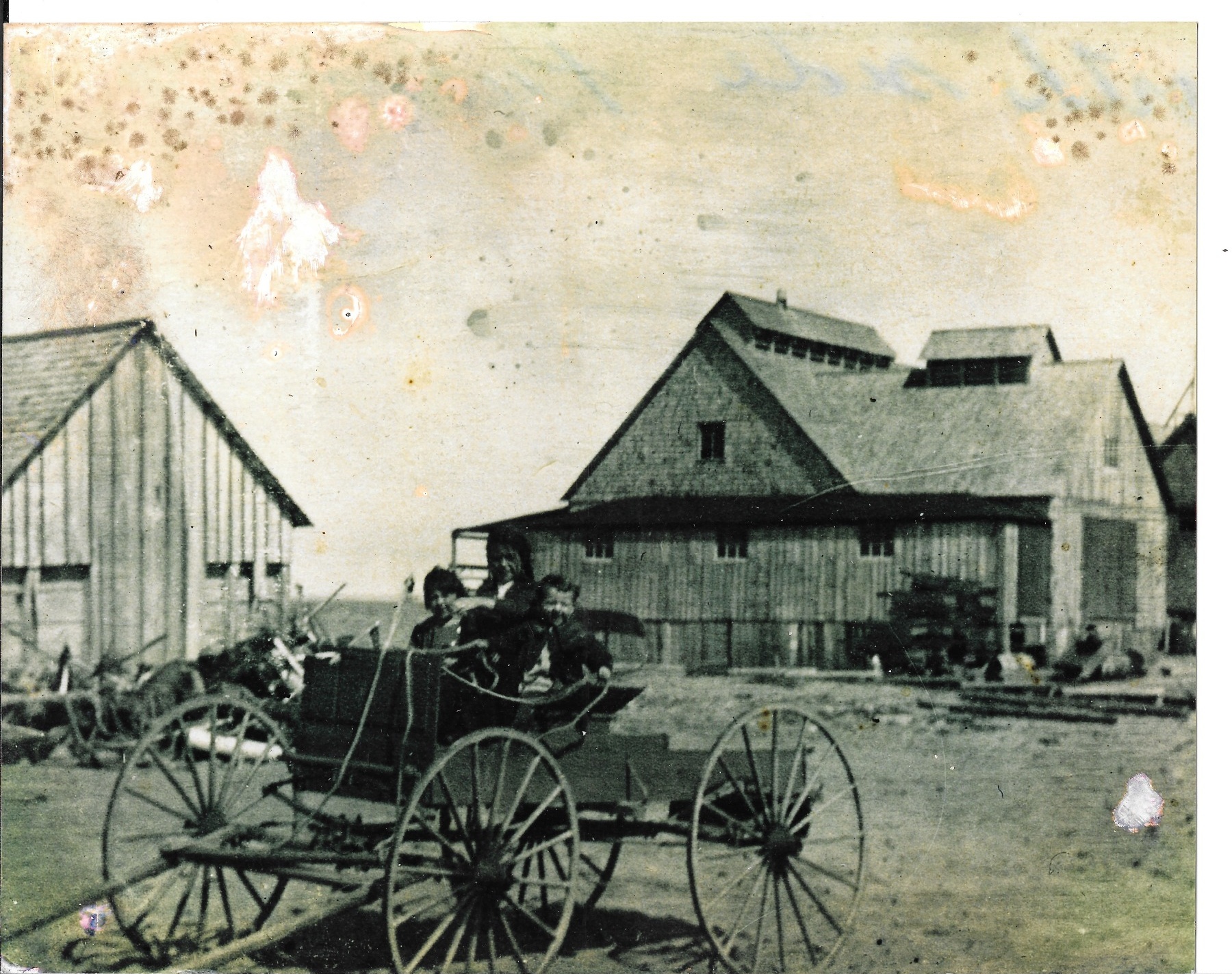
Factory RoadOpen history, photographs and sourcesRepresentative Island cannery scene. Ray Hayman / PIHS collection. Date, operator and exact building location unidentified; not a verified view of Factory Road.
Factory Road
Ron MacDonald remembers Factory Road as “New Factory Road,” leading to New Factory Cove and its canneries. This is a different place from John Dans Cove, once known as Lobster Factory Cove. The map shows the approximate New Factory Cove locality.
Read the full history
North Shore Road on a historical map; New Factory Road in local memory
Names of the road
On a map reproduced by Kenneth MacCallum, the road corresponding to today’s Factory Road is labelled ‘North Shore Road.’ Ron MacDonald remembered the road as ‘New Factory Road,’ leading to ‘New Factory Cove.’ The dates, overlap and sequence of these names have not yet been established.
A road to the working shore
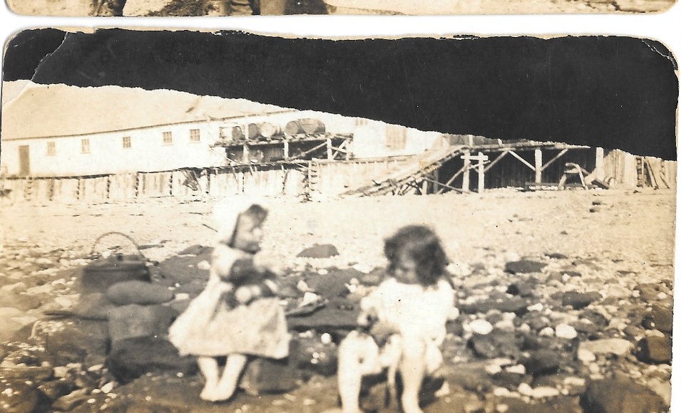
Factory Road preserves the memory of a North Shore cannery landscape. Historical photographs show large wooden industrial buildings, a horse-drawn carriage, shoreline structures and people at the water’s edge. The dates, operators and exact building locations in these views remain unidentified.
Earlier mapping shows a trail or portage toward a cannery, but it does not establish that the modern road follows every part of the same alignment or carried its present name in the nineteenth century.
New Factory Road and New Factory Cove
Ron remembers the road and cove by their New Factory names. Local knowledge places the cove at marker 12 on the PIHS map, separate from John Dans Cove; the marker does not show an exact factory footprint.
The names preserve memories of the factory shore, although the operator of each building is not known.
Factories around the Island
The 1895 federal table lists McClure Bros. at West End and North Side, D. McKenzie at North Side, and James Hogg at East End. The entries show factories in several parts of the Island, but do not locate either North Side operator at this road or at New Factory Cove.
Federal returns record three Pictou Island canneries in each of 1903, 1906 and 1907. The number of canneries changed over time; the returns do not establish that the same buildings operated throughout.
Reading the photographs
Ray Hayman’s collection preserves a horse-drawn carriage among substantial industrial buildings and children beside shoreline buildings and wharf structures. These images show the character of factory life. Their exact dates, operators and building locations remain unidentified.
Children beside shoreline industrial buildings. People, date and exact site unidentified. Ray Hayman / PIHS collection.
Sources and further reading
Map reproduced by Kenneth MacCallum, supplied to PIHS on 29 September 2026: North Shore Road label; Local knowledge identifies the corresponding present road as Factory Road. The map-name chronology remains unresolved.Source enquiries: PIHS research resources
Ron MacDonald, local oral history recorded by PIHS, 16 September 2026: New Factory Road and New Factory Cove.Source enquiries: PIHS research resources
Federal fisheries records: 1895 factory entries; annual returns for 1903, 1906 and 1907.Source enquiries: PIHS research resources
PIHS map location correction based on local knowledge, 16 September 2026: New Factory Cove at the existing shoreline marker 12; historical Lobster Factory Cove belongs at marker 11, John Dans Cove.Source enquiries: PIHS research resources
Ray Hayman / PIHS collection, RH_001_factory_road and RH_022_children_cannery_shore; dates, operators and exact sites unidentified.Source enquiries: PIHS research resources
John Dans CoveOpen history, photographs and sourcesJohn Dans Cove — detail from the PIHS illustrated heritage map. Interpretive illustration.
John Dans Cove
A. H. MacKay recorded the name “Lobster Factory Cove” in his 1891 account of Pictou Island. Ron MacDonald identifies that historic cove as the place Islanders now call John Dans Cove, also written John Dan’s Cove.
Read the full history
John Dans Cove — historically Lobster Factory Cove
The cove and its historical name
John Dans Cove is the official geographic name; John Dan’s Cove is a local spelling. MacKay’s 1891 account records “Lobster Factory Cove,” describing a white sandy cove receiving two small brooks near a lobster factory. Ron MacDonald identifies that historic name with today’s John Dans Cove.
The cove is named for John Dan MacLeod, a Prince Edward Islander associated with its factory. Brenda Spence MacLeod records that he and a group of Prince Edward Island fishermen opened a factory there when the place was known as Factory Cove. A Prince Edward Island legislative biography also identifies John Dan as Norman MacLeod’s brother and cannery partner. The factory’s dates, legal ownership and later operators remain uncertain.
John MacLeod in the documentary record
The marriage registration of 16 April 1912 records John Dan MacLeod, entered as John D. McLeod, as a lobster packer living on Pictou Island and born at High Bank, Prince Edward Island. His bride Ethel McKenzie was recorded as Island-born and resident there. Local identification links John D. with John Dan, read with the documentary occupation, residence and Norman MacLeod partnership. The ceremony took place in Pictou. The return does not identify a factory parcel or establish that Ethel worked in a cannery.
A working North Shore
More than one cannery operated along the North Shore. Federal records list McClure Bros. and D. McKenzie at North Side in 1895, and McLeod & Stewart of High Banks, Prince Edward Island, at Pictou Island in 1905. The records do not place each operation at John Dans Cove.
Local accounts remember a factory at the cove, though the dates, owners and positions of individual buildings remain uncertain. The cannery symbol on the map is an illustration informed by Ray Hayman photographs and historical maps; it does not show an exact building footprint or a particular year.
John Dan’s Way and Campbell Lane
A 2023 community-map reference records the name John Dan’s Way. Local knowledge identifies the same route toward the cove as Campbell Lane, also written Campbell’s Lane. The sequence and dates of these names have not been established.
The lane is remembered as wide enough for horses and buggies travelling to the factory area. Its exact age and original course are uncertain.
Campbell Lane lies east of Sutherland Memorial Church, more directly behind the schoolhouse. The dotted line shows the remembered route approximately. The newer, private Josh & Julia Way runs roughly parallel; the map does not establish public access along the older route.
Photographs and the changing shore
Kenneth MacCallum’s history includes a photograph captioned “John Dan’s Cove on the north shore of Pictou Island.” A separate photograph shows a North Shore lobster factory; it is not known whether that photograph shows this cove.
Brenda Spence MacLeod recalls Hurricane Fiona exposing traces of factories at John Dan’s Cove and the New Factory site before the sand covered them again. Others remember brickwork at the cove; the age and identity of the individual remains are uncertain.
Ron MacDonald, local oral history recorded by PIHS, 16 September 2026: identification with present John Dans Cove; New Factory Road and New Factory Cove recollections.Source enquiries: PIHS research resources
Brenda Spence MacLeod, PIHS local-history account; local route information shared with PIHS.Source enquiries: PIHS research resources
Kenneth MacCallum, Pictou Island history, North Shore and cannery photographs.Source enquiries: PIHS research resources
Federal fisheries records: 1895 North Side entries and 1905 packer schedule.Source enquiries: PIHS research resources
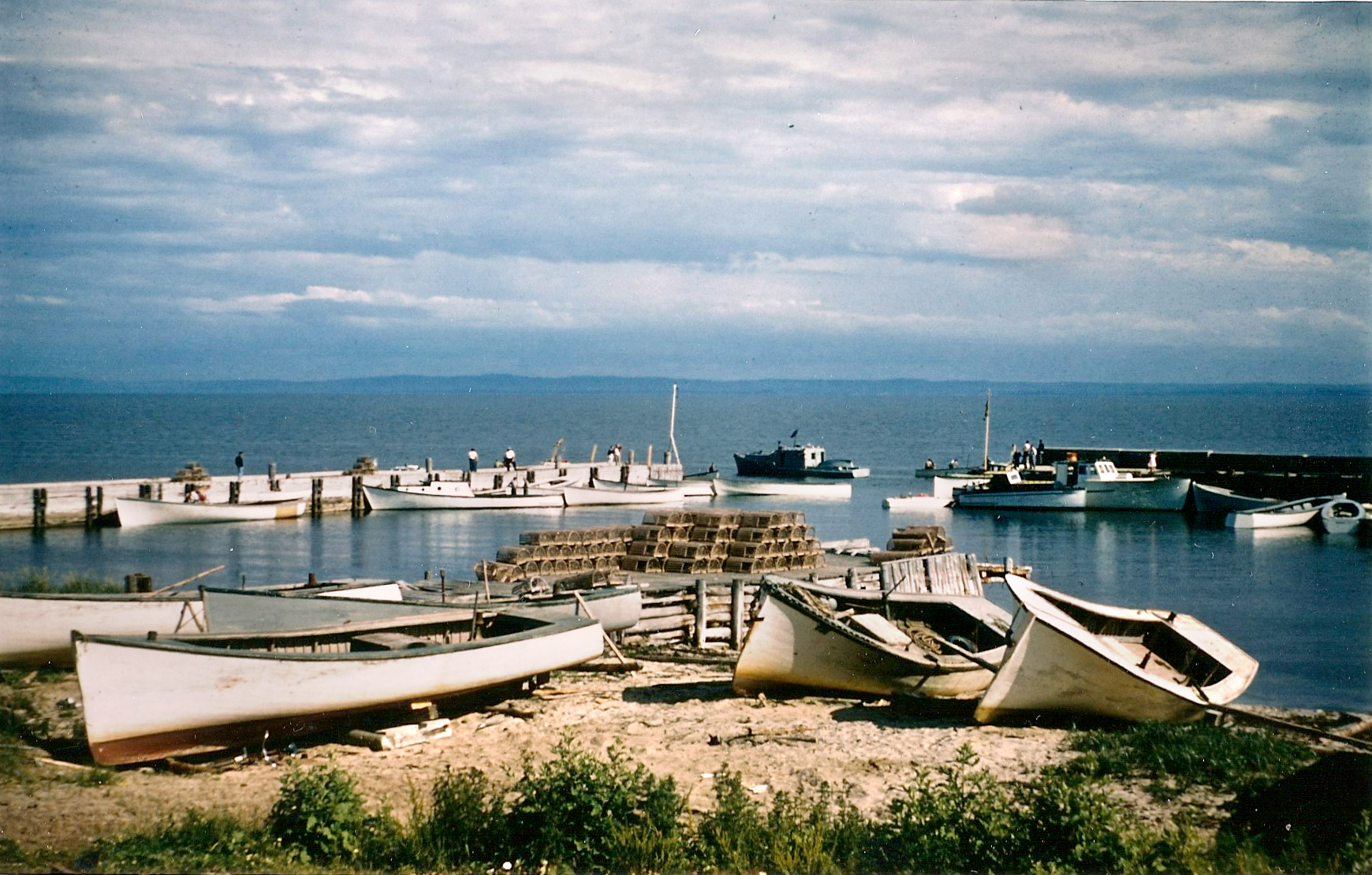
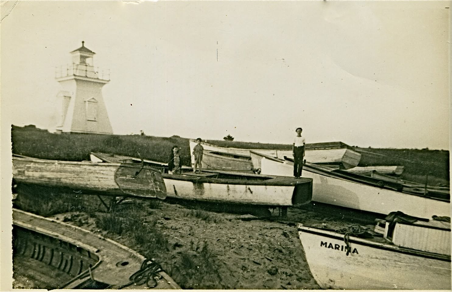
Roger PointOpen history, photographs and sourcesBoats beside the South Side Lighthouse and wharf. MARITA is visible on one boat; the photograph’s date and the people pictured remain unidentified. Hugh MacLean / PIHS collection. A contextual view of the Island’s maritime life.
Roger Point
On Pictou Island’s south shore, Roger Point is easy to overlook on a modern map. Historically, however, it was a useful landmark for people approaching the Island by water and one of the places where the Island’s geography shaped how people travelled and communicated.
Read the full history
Navigation, landing and connection on Pictou Island’s south shore
Roger Point appears on nineteenth-century navigational mapping and was firmly established as a maritime place name by the later 1800s. Sailing directions published in 1891 described the point as sandy and identified it as the best landing for boats on Pictou Island. In an era before dependable wharves, regular ferries and modern roads, a sheltered or workable landing place could be an important part of everyday Island life.
The point later became associated with another kind of connection across the Strait. Federal Public Works records show that in July 1921 the government cableship C.G.S. Tyrian laid a new submarine telephone cable between Pictou and Pictou Island. The Public Works report records repairs to the Pictou Island cable on 23–26 May 1923. Later Canadian Sailing Directions identify the submarine-cable route specifically as running between Roger Point on Pictou Island and Widow Point on the mainland.
A later cable linked Roger Point and Widow Point. Whether the first cable in 1921 used the same landings is uncertain. Telephone service gave Islanders a new way to speak directly with the mainland, alongside older forms of signalling and travel.
Mid-twentieth-century aerial photographs show open fields, farmsteads and roads around central Pictou Island, with a shoreline less wooded than it is today. They offer a glimpse of the farming and maritime landscape around Roger Point.
Roger Point is the official geographic name; some Islanders also say Roger’s Point. Rogers families lived on Pictou Island, but it is not known how the point got its name.
From a landmark and boat landing to a link in the Island’s telephone connection, Roger Point is one of the places where Islanders met the Strait and the mainland beyond.
Sources and further reading
Canadian Geographical Names Database, Roger Point (CBGHJ).Source enquiries: PIHS research resources
Department of Public Works reports, years ending 31 March 1922 and 1924, C.G.S. Tyrian operations.Source enquiries: PIHS research resources
Canadian Sailing Directions ATL 108, Gulf of St. Lawrence (Southwest Portion).Source enquiries: PIHS research resources
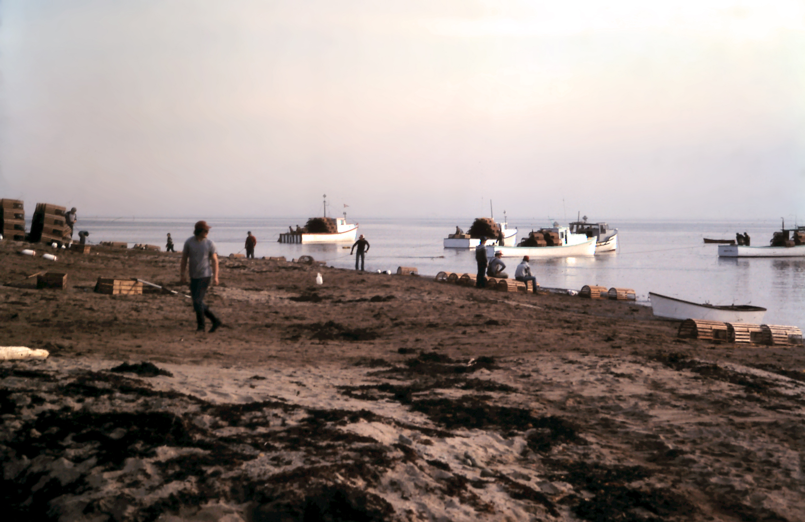
East End Fish ShantiesOpen history, photographs and sourcesEast End, May 1, 1983. Boats, traps and shore work. Darrell Rankin slide. Andrea Rankin Sibley collection. This view documents fishing activity; the shanties are outside the frame.
East End Fish Shanties
The East End fish shanties are still on the landscape and remain in use. They belong to a working shore where seasonal fishermen stayed and boats, traps and fishing gear were handled. Lobster fishing and shore work have connected this part of Pictou Island with the surrounding waters for well over a century.
Read the full history
A surviving working shore
A long fishing history
A lobster factory is documented at the East End by the 1890s. The federal fisheries record for 1895 lists an East End establishment under Jas. Hogg. Factory work formed one part of a wider shore economy that included catching lobster, landing supplies, handling boats and maintaining fishing gear.
Fishing and shore work continued after local canning ended. The shanties tell part of that longer story.
Staying for the season
In an oral history recorded for the Pictou–Antigonish Regional Library’s lobster project in 2000, Lorraine MacMillan recalled mainland fishermen coming to the Island for the lobster season and staying in small East End fish shanties. She also remembered seasonal accommodation for cannery workers who lived too far away to walk to work.
The shanties provided seasonal accommodation and space for fishing work, with traps, boats and gear nearby. Kenneth MacCallum’s history reproduces a photograph of Clarence and Judson Nicolle, fishermen from Prince Edward Island, at an East End shanty in the 1990s. Its caption also identifies a newer shanty in the background—a reminder that the buildings changed over time.
The shore in photographs
Photographs clearly document the shanty landscape by the 1950s. A 1959 view reproduced by MacCallum shows the buildings from Lauchie Dan MacCallum’s house; its caption identifies a long, narrow boathouse. Later photographs show shanties and traps in August 1980, the Nicolles in the 1990s, and the shoreline from the air in August 2005.
Together, the photographs show the shore at different times. The boathouse is identified in the 1959 view; the histories of individual buildings visible today are not all known.
The cannery and the shanties
The former lobster factory and the surviving shanties tell different parts of the East End story. Some of today’s shanties may have been built after the cannery years.
MacCallum suggested where the factories may have stood, though their exact locations are unknown. The map marks the shanty area.
Still part of Island life
The shanties remain on the shoreline and are still used today, part of a working fishing community.
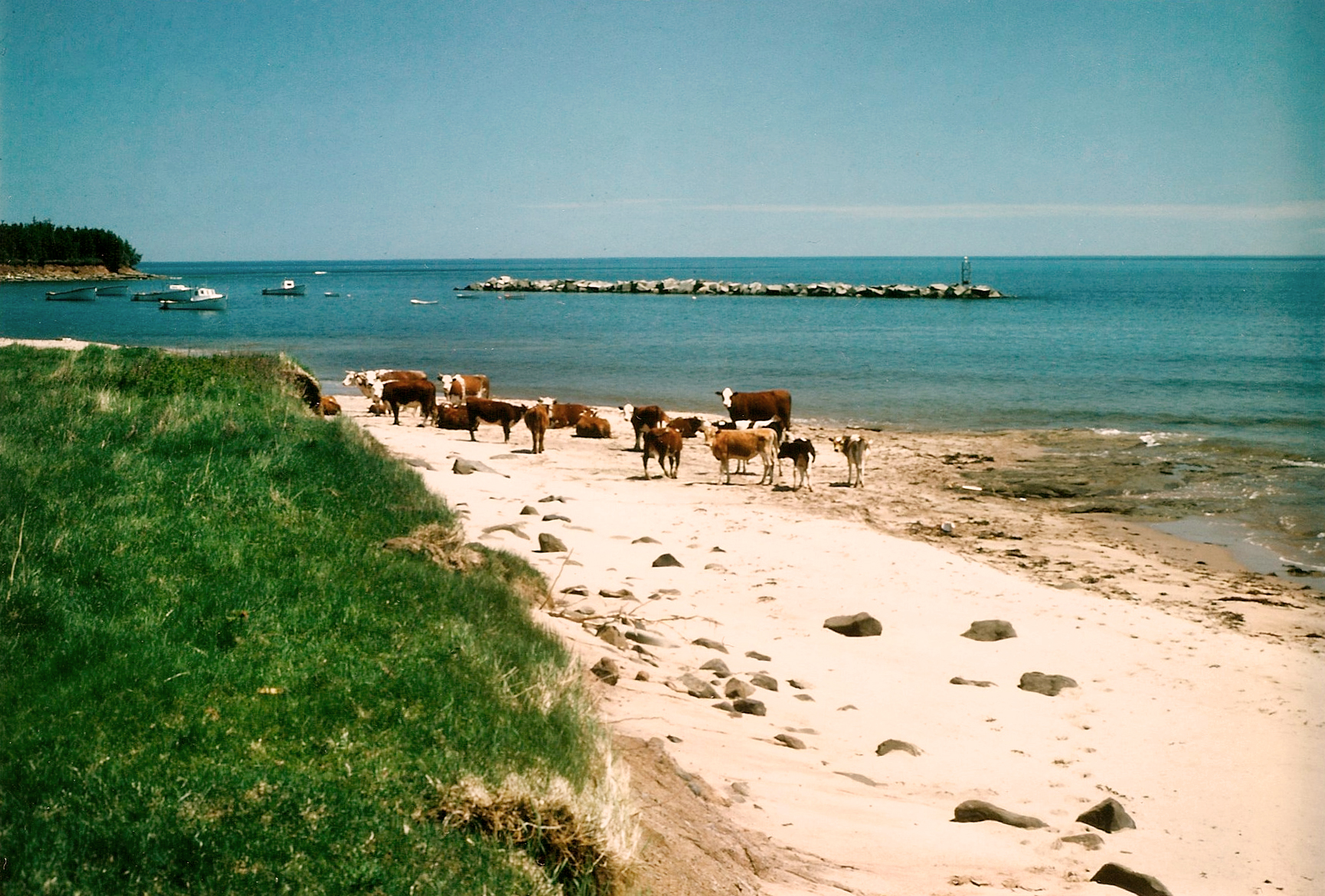
East End shoreline, 1970s or early 1980s. Cattle on the beach near the harbour; Darrell Rankin slides, Andrea Rankin Sibley collection. A view of the wider shore setting.
Sources and further reading
Department of Marine and Fisheries, 1895 factory entries: East End — Jas. Hogg.Source enquiries: PIHS research resources
Kenneth MacCallum, Pictou Island, Nova Scotia: Its History and People, pp. 84, 87 and 100; Figures 33, 36, 40 and 41.Source enquiries: PIHS research resources
Lorraine MacMillan, oral history recorded by Kate Romanowsky for the Pictou–Antigonish Regional Library’s American Lobster project, 2000.Source enquiries: PIHS research resources
Darrell Rankin slides, Andrea Rankin Sibley collection: East End, May 1, 1983; East End shoreline, 1970s or early 1980s.Source enquiries: PIHS research resources
Present-day continuity confirmed by PIHS, September 2026.Source enquiries: PIHS research resources
East End ReefOpen history, photographs and sourcesEast End Reef — approximate locality detail from the illustrated map. The reef position is approximate.
East End Reef
A reef near the northern end of the Island, shown approximately on the map. A place-name atlas suggests it may be the historic Seal Rock, though the connection remains uncertain.
Read the full history
A reef near the Island’s northern shore
A reef with more than one possible name
East End Reef lies near the northern end of the Island. A place-name atlas suggests it may be the historic Seal Rock, although that connection remains uncertain. Seal Rock was the name of a rock or reef; Seal Point was a name for the East End point. Asadalia Reef is a separate feature southwest of the East End breakwater.
Navigation and local knowledge
The reef is part of waters familiar to Island boaters. The map shows its approximate location near the northern shore, not the reef’s surveyed extent or a precise wreck position.
A 1908 casualty record places the Calluna at Seal Rock in the Pictou Island area, but does not give a precise wreck position.
Sources and further reading
Pictou County place-name atlas: secondary identification of historical Seal Rock with East End Reef; the correspondence is not yet confirmed by the surviving primary records.Source enquiries: PIHS research resources
Canadian Hydrographic Service, ATL 108, Gulf of St. Lawrence (Southwest Portion).Source enquiries: PIHS research resources
Official casualty record for Calluna, 10 November 1908: Seal Rock / Pictou Island area.Source enquiries: PIHS research resources
Nineteenth-century atlas and 2023 community-map references; the placement shown here remains approximate.Source enquiries: PIHS research resources
East End BreakwaterOpen history, photographs and sourcesEast End shoreline, 1970s or early 1980s. Boats and the offshore breakwater are visible. Darrell Rankin slides, Andrea Rankin Sibley collection.
East End Breakwater
The East End Breakwater sheltered the harbour and working shore. It was present in the twentieth century and is separate from the cannery and fish shanties.
Read the full history
Shelter for a continuing working shore
A harbour structure
The East End Breakwater sheltered boats and the people who worked along the shore. Nearby stood fish shanties and the historic cannery.
The breakwater over time
A registry plan dates from 1938, and a breakwater is shown by 1954. Later harbour records distinguish the East and West Breakwaters. Its original construction date and the full history of repairs and replacement are not yet known.
A photograph catalogue describes fishing shanties beside a cove sheltered by a breakwater outside the picture.
Life along the shore
With shelter from the breakwater, fishermen could handle boats, move traps and gear, and carry on seasonal work along the East End shore.
Sources and further reading
Registry plan (1938) and harbour evidence showing a breakwater by 1954; the original construction and replacement history remains incomplete.Source enquiries: PIHS research resources
An Iodhlann, object 2008.46.14 (M166), Fishing shanties and breakwater cove.Source enquiries: PIHS research resources
East End CanneryOpen history, photographs and sourcesEast End shoreline, 1970s or early 1980s. Darrell Rankin slides, Andrea Rankin Sibley collection. A later view of the shore setting; no building in this photograph is identified here as a cannery.
East End Cannery
Lobster factories operated at the East End by the 1890s. Fishing continues along this working shore, and some fish shanties still stand.
Read the full history
Historic lobster factories on the working shore
A factory on the shore
An 1895 federal fisheries record lists an East End factory under Jas. Hogg. It does not identify a surviving building as that factory.
Where were the factories?
In a caption to his August 2005 aerial photograph, Kenneth MacCallum suggested where the Shedd & Knox and Magee factories may have stood, using the park, brook, shanties and beach roads as guides. Their exact footprints are unknown.
On the map, a numbered label sits offshore for clarity and a dotted line points toward the general factory area on shore.
Separate from the fish shanties
The former factories and the fish shanties tell different parts of the East End story. The shanties remain in use, but not all necessarily date from the cannery years, and none has been identified as a former factory building.
Sources and further reading
Department of Marine and Fisheries, 1895 factory entries: East End — Jas. Hogg.Source enquiries: PIHS research resources
Kenneth MacCallum, Pictou Island, Nova Scotia: Its History and People, p. 100, Figure 40: East End aerial, August 2005; caption identifies probable factory positions.Source enquiries: PIHS research resources
Darrell Rankin slides, Andrea Rankin Sibley collection: East End shoreline, 1970s or early 1980s.Source enquiries: PIHS research resources
Asadalia ReefOpen history, photographs and sources
Asadalia Reef
Southwest of the East End breakwater lies a reef known to Island fishermen as Asadalia Reef. Visible from shore, it is remembered in connection with a shipwreck. Boats keep clear, especially at low tide. The map shows its approximate location; the 1827 report of the Asadalia’s loss does not name the reef.
Read the full history
A reef, a remembered shipwreck and fishermen’s local knowledge
Asadalia — 5 November 1827
Asadalia is the earliest documented shipwreck in this exhibit. On 10 December 1827, The Standard of London printed a short notice in ‘Ship News — By This Day’s Post’ on page 3:
‘The Asadalia, from Liverpool, was lost on Pictou Island, on the 5th ult.’
‘Ult.’ means the previous month: the notice reports a loss on 5 November 1827. The notice says the vessel came from Liverpool and was lost on Pictou Island.
Local fishermen associate the wreck with Asadalia Reef southwest of the East End breakwater. The newspaper records the Island loss; the reef’s name and more specific location are preserved through local knowledge.
Known from shore and water
Asadalia Reef lies southwest of the East End breakwater. Islanders describe a reef visible from shore and familiar to people who travel these waters by boat. Fishermen know to keep clear of it, particularly at low tide.
The reef’s name lives on in local knowledge of the shore and sea. It is separate from East End Reef and the Seal Rock locality beyond the Island’s northern tip.
The remembered shipwreck
Local accounts associate Asadalia Reef with a shipwreck remembered as Asadalia. The reef and the wreck story remain familiar to former Island fishermen, connecting maritime history with a hazard that people still recognize today.
Local accounts recorded in September 2026 include recollections from former fishermen Ron MacDonald, Darrell Rankin and Almer MacDonald. Darrell described the reef and its wreck association; the other accounts corroborated familiarity with both. A local account identified the locality as southwest of the breakwater.
These local accounts connect the reef with the shipwreck. The newspaper notice records Asadalia’s loss at Pictou Island in 1827.
A name carried forward
According to Darrell Rankin, his son, Jason Rankin, named Asadalia Fisheries in honour of the reef and shipwreck’s history. The name carries that maritime memory into a later generation of the fishing family.
A 2021 Fisheries and Aquaculture Loan Board profile identifies Jason with Asadalia Fisheries Ltd. and shows Jason and his father, Darrell, fishing together off Pictou Island’s East End. The explanation of the company’s name is attributed to Darrell’s account.
Locating the reef
The map marks the reef’s approximate location southwest of the breakwater. It does not show the reef’s surveyed extent, the wreck’s position on the seabed or a safe passage. No particular wreck remains have been identified here.
Sources and further reading
Local knowledge from former fishermen Ron MacDonald, Darrell Rankin and Almer MacDonald, recorded September 2026. Darrell’s account described the reef and wreck association.Source enquiries: PIHS research resources
Local location clarification: southwest of the East End breakwater; visible from shore and known to boat users, particularly at low tide, September 2026.Source enquiries: PIHS research resources
Darrell Rankin’s explanation of the Asadalia Fisheries name, recorded September 2026.Source enquiries: PIHS research resources
The Standard (London), 10 December 1827, p. 3, ‘Ship News — By This Day’s Post.’ Original notice inspected from the newspaper screenshots supplied to PIHS in September 2026; the line break in ‘Island’ has been joined in the transcription.Source enquiries: PIHS research resources
West End CanneryOpen history, photographs and sourcesRepresentative Island cannery scene: horse-drawn carriage and wooden factory buildings. Ray Hayman / PIHS collection, RH_001_factory_road. Date, operator and exact site unidentified; not a verified view of the West End cannery.
West End Cannery
The West End cannery was part of a working shore where lobster was caught and processed for markets across the Strait. Local history places it north of the main road, above the beach near the western lighthouse and road end.
Read the full history
A remembered factory above the western beach
Remembering the location
Ron MacDonald, son of the West End lightkeeper, remembered the cannery in this area above the beach. The map marks the general location, not the outlines of its buildings or property.
This West End site is separate from John Dans Cove, once known as Lobster Factory Cove, and from Factory Road on the North Shore.
Factories around the Island
An 1895 federal table lists McClure Bros. at West End, along with factories at North Side and East End. The record does not establish who operated the cannery remembered here or exactly where it stood.
Explore seasonal fishing and factory work in The Lobster Island exhibit.
A glimpse of cannery life
A Ray Hayman photograph shows a horse-drawn carriage among large wooden factory buildings. It gives a sense of Island cannery life, although the site has not been identified as West End. The map illustration is also representative rather than a reconstruction of these particular buildings.
Sources and further reading
Ron MacDonald, son of the West End lightkeeper: local identification recorded by PIHS, 14 September 2026.Source enquiries: PIHS research resources
Federal fisheries factory table, 1895, West End and separate North Side entries.Source enquiries: PIHS research resources
Ray Hayman / PIHS collection, RH_001_factory_road; representative photograph, exact site unidentified.Source enquiries: PIHS research resources
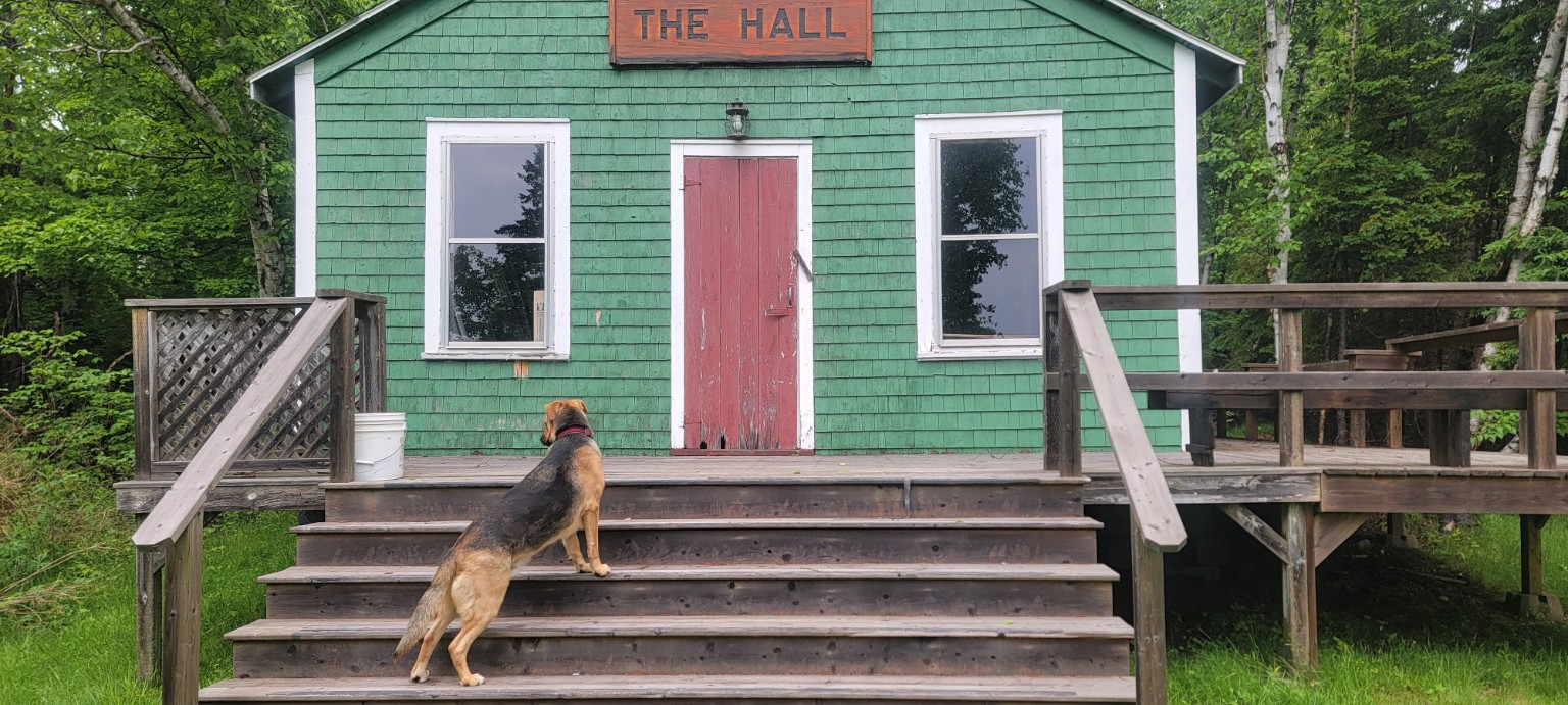
The HallOpen history, photographs and sourcesEnlarge & zoomThe Hall, Pictou Island. Photograph: PIHS.
The Hall
The Dance Hall, Pictou Island Hall and Pictou Island Community Hall are names for the same place at 819 Pictou Island Road. The green Hall is a gathering place for dances, music and Kitchen Parties. It is separate from the former schoolhouse and Community Centre.
Pictou Island WharfOpen history, photographs and sourcesEnlarge & zoomPictou Island Wharf. Photograph: PIHS.
Pictou Island Wharf
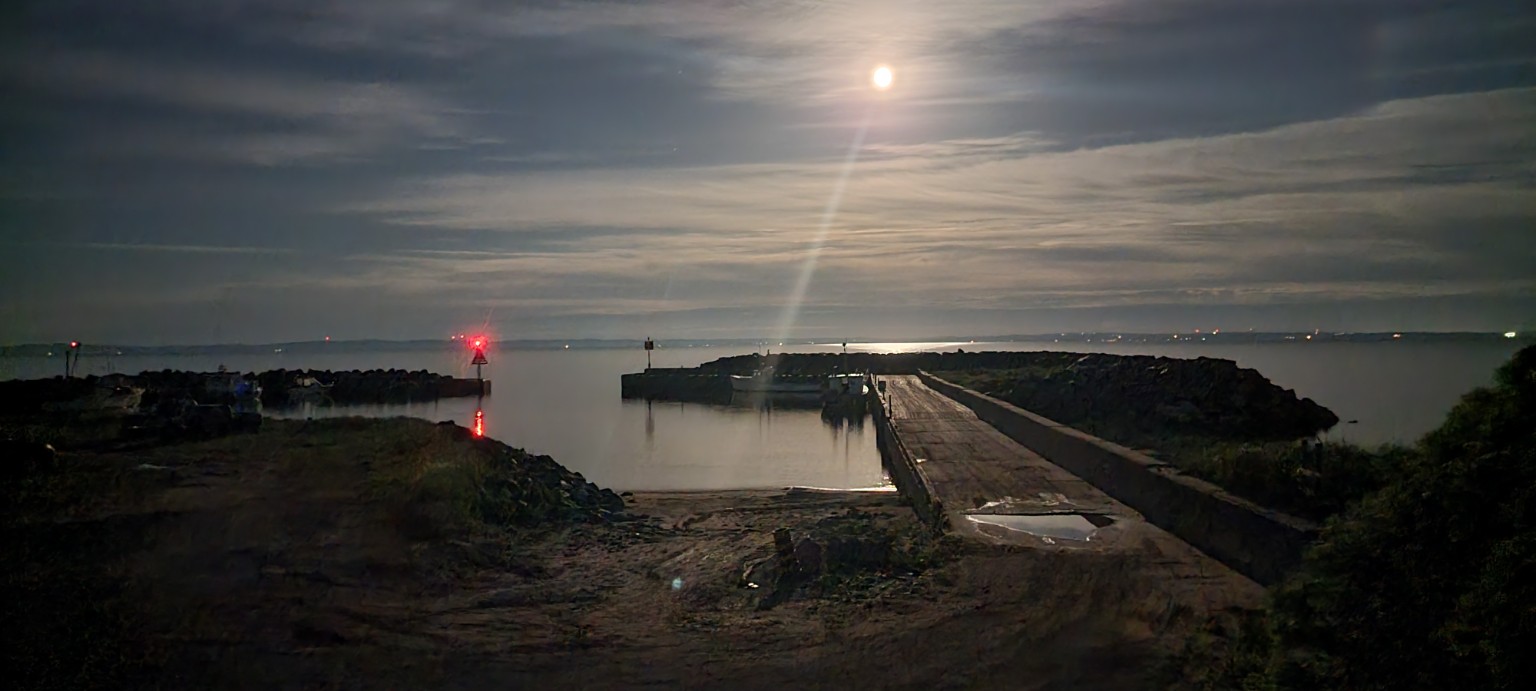
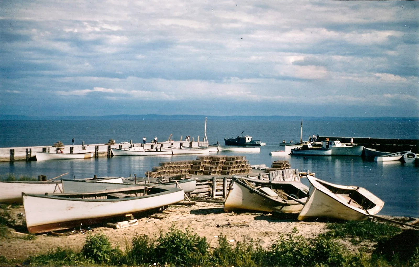
The wharf connects island life with the waters of Northumberland Strait. The Southside Lighthouse stands beside it. Boats, fishing and travel between the island and mainland are part of its wider story.
Church CemeteryOpen history, photographs and sourcesEnlarge & zoom
Church Cemetery
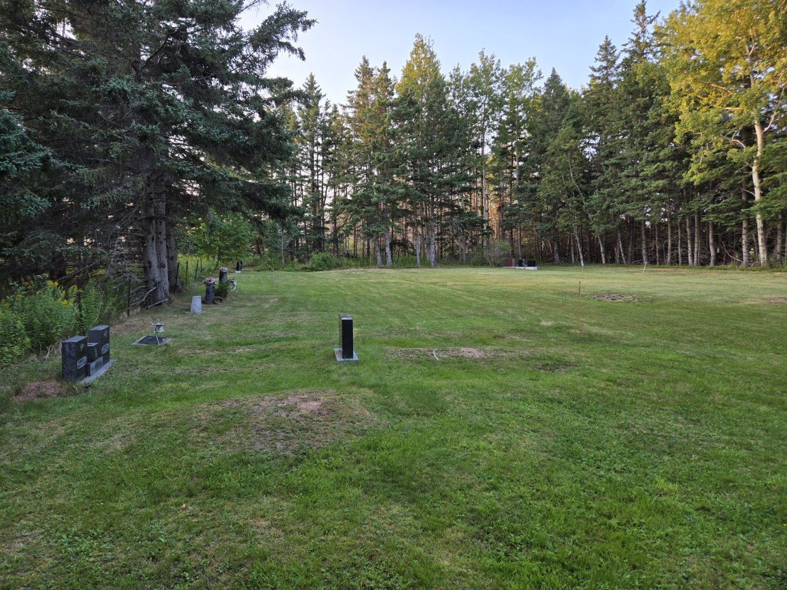
The later burial ground associated with Sutherland Memorial Church is distinct from Pioneer Cemetery. Both preserve connections to island families and the community’s traditions of remembrance.
East End Park (John MacCallum Park)Open history, photographs and sources
East End Park (John MacCallum Park)
John MacCallum Memorial Park at the East End is a place for picnics, recreation and community gathering. It is also part of the island’s modern heritage-event landscape.
Pictou Island lies in the Northumberland Strait between Nova Scotia and Prince Edward Island. Visitors come for community events, heritage places, beaches, quiet roads, and shoreline views.
The island is off-grid and has no bridge or public store. Arrange transportation and accommodation in advance, allow for weather changes, and bring the supplies you will need.
Confirm transportation, accommodation, and seasonal access directly before travelling.
Crossing to Pictou IslandOpen history, photographs and sources
Getting here
Crossing to Pictou Island
With no bridge to the island, visitors arrive by boat or another available service. Confirm your crossing in advance, allow for weather changes, and bring the supplies you will need. Passenger transportation may be available through Pictou Island Charters.
Explore island heritageOpen history, photographs and sources
Things to do
Explore island heritage
Begin with the documented heritage places on this page. Records for the South, West and East lighthouses, Sutherland Memorial Church, and Pioneer Cemetery each link to the completed PIHS interpretive panel without using the panel as a photograph. Beaches, quiet roads, community events, and changing views of the Northumberland Strait are also part of an island visit. On the mainland, the Northumberland Fisheries Museum on the Pictou waterfront is another source of island and regional fishery history.
Arrange accommodation earlyOpen history, photographs and sources
Where to stay
Arrange accommodation early
Accommodation is limited. Current island options include Pictou Island Wooden Tents and Pictou Island Yurts. Contact each host directly to confirm dates, services, and arrival arrangements before booking travel.