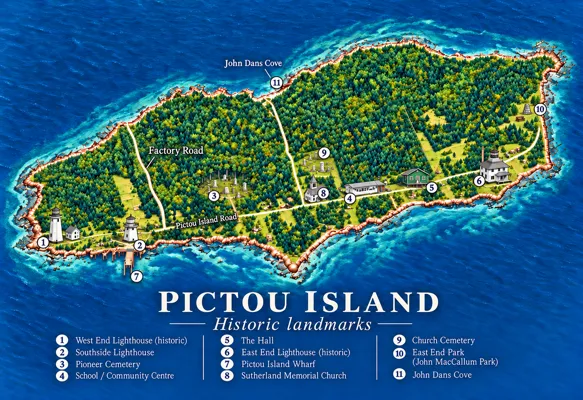
PIHS · illustrated landmark guide
Island Landmarks
Explore the Island’s landmarks, communities and historic places through our illustrated map.
Explore 19 landmarks → Virtual Museum
Discover historic places, examine maps from different centuries, and explore our cartographic collection.
PIHS · illustrated landmark guide
Explore the Island’s landmarks, communities and historic places through our illustrated map.
Explore 19 landmarks →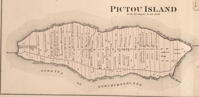
Meacham, 1879 · original historical map
Explore how Pictou Island was mapped, settled and recorded through time.
Explore historical maps →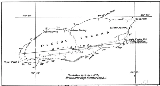
A. H. MacKay, 1891 · detail after Hugh Fletcher
Browse historical maps, surveys, charts, plans and maps enhanced or created by PIHS.
Browse the collection →Historical maps reflect their makers, dates and purposes. Property labels are not proof of present-day ownership; modern illustrated maps are identified as interpretations.