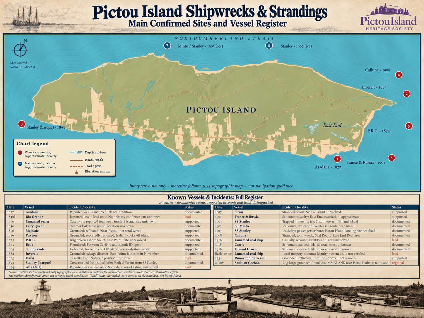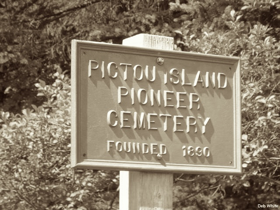
Pioneer Cemetery plot plan
The regional library’s plot plan accompanies memorial photographs and research. It is not a complete burial register.
Open the plot plan Virtual Museum
Pictou Island Heritage Society · Virtual Museum
Explore cartographic sources that describe Pictou Island and its changing landscape.
Historical originals, enhanced details and PIHS interpretations sit alongside source references for maps and plans held elsewhere. Some entries describe groups of records or geographic accounts rather than a single map.
Preview images appear only where an approved display asset is available. Full source and access information remain with each entry.
43 of 43 entries
Source reference · Contemporary
Akukomijk and its attributed translation in a contemporary place-name atlas.
Early Maps & Island Names · View online
Source reference · 1965
George T. Bates’s historical Mi’kmaw place-name map. Ask Nova Scotia Archives about access and reproduction.
Early Maps & Island Names · Repository enquiry
Source reference · c.1993
A Native Council of Nova Scotia cultural-geography map. Consult the Council about the appropriate edition and reuse.
Early Maps & Island Names · Repository enquiry
Source reference · Contemporary
A guide to Mi’kma’ki cultural geography. District lines should not be read as surveyed ancient boundaries.
Early Maps & Island Names · View online
Source reference · 2011
Regional cultural-geography mapping and the recorded form Kensenkuk. The report’s different place-name forms should not be treated as interchangeable.
Early Maps & Island Names · View online
Source reference · 1672
A descriptive account of regional geography, rather than a standalone map of Pictou Island.
Early Maps & Island Names · View online
Source reference · 1702–1711
Early French cartographic context. Consult the Bibliothèque nationale de France for the map and its catalogue description.
Early Maps & Island Names · Repository enquiry
Source reference · 1733 / 1746
Regional Sheet 7: David Rumsey 2874.009 (1733) and 5810.017 (1746). I. Cocagne may represent Pictou Island, but the identification is unproven. Both states belong to one cartographic tradition.
Early Maps & Island Names · View online
Source reference · 1757
Labels I. Pictou and Cocagne separately. View the map and reproduction information at Library and Archives Canada.
Early Maps & Island Names · View online
Source reference · 1764
The Petit Atlas Maritime map distinguishes I. Pictou from Cocagne. View the Library of Congress copy.
Early Maps & Island Names · View online
Source reference · 1777
A Northumberland Strait chart from the Atlantic Neptune. Boston Public Library / Leventhal Map & Education Center.
Early Maps & Island Names · View online
Source reference · 1809
Survey and grant records associated with Cochrane, in Nova Scotia Archives Land Papers 2755. The documents should not be read as a modern parcel survey.
Settlement & Land Ownership · Repository enquiry
Source reference · 10 May 1830
A numbered plan mentioned in later deeds. Ask Nova Scotia Archives about the original plan dated 10 May 1830 and its Peter Crerar attribution.
Settlement & Land Ownership · Repository enquiry
Source reference · 1834
An island-outline sheet from MacKay’s Great Map. It is not the 1830 property division plan.
Settlement & Land Ownership · View online
Source reference · Date unconfirmed
A county-map reference used in local road history. Ask Nova Scotia Archives about the Pictou County map’s edition and island coverage.
Settlement & Land Ownership · Repository enquiry
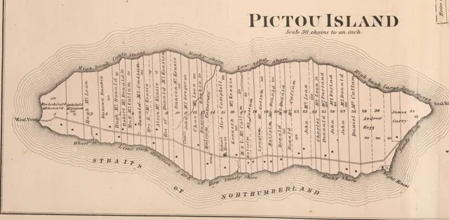
Historical original · 1879
Printed property names, divisions and features in Section 19. The labels do not establish modern property boundaries or resolve people with the same name.
Settlement & Land Ownership · Explore with PIHS
J. H. Meacham & Co., 1879 · PIHS supplied scan · public domain
Explore this map →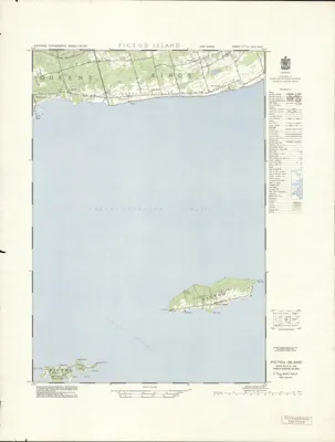
Historical original · 1953
Contains Pictou Island. Downloadable georeferenced raster and source metadata at Borealis. CC0 1.0 (public-domain dedication).
Topography & Aerial Views · View online
Canada, NTS 11 E/15 East, 1953 · Borealis · CC0 1.0
Explore this map →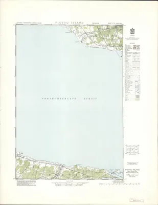
Historical original · 1953
Covers adjacent strait and mainland, rather than the island itself. Borealis lists this dataset under CC0 1.0, a public-domain dedication.
Topography & Aerial Views · View online
Canada, NTS 11 E/15 West, 1953 · Borealis · CC0 1.0
Explore this map →Source reference · 1960, unconfirmed
A later map reference with several possible editions. Ask Nova Scotia Archives about available Pictou Island topographic editions.
Topography & Aerial Views · Repository enquiry
Source reference · 1964
Nova Scotia Archives Library call number O/S G3416 G4 N68 C-32. Consult the Library about access to this Crown Lands map.
Settlement & Land Ownership · Repository enquiry
Source reference · 1965
Nova Scotia Archives Library call number O/S G3422 P53 N68 1965. Consult the Library about access to this Lands & Forests map.
Settlement & Land Ownership · Repository enquiry
Source reference · 1977
Ask Nova Scotia Archives about the Pictou Island map dated 1977.
Settlement & Land Ownership · Repository enquiry
Source reference · 1988
District 1, properties 802–822. Ask Nova Scotia Archives about the Pictou Island heritage inventory and associated site plans.
Settlement & Land Ownership · Repository enquiry
Source reference · Various
Road, Boat House Lot and factory-area references: Book 219 pp.547–549; File 9 nos.51–52; Book 372 pp.4, 20–21, 45. Ask about associated plans as well as deed text.
Settlement & Land Ownership · Repository enquiry
Source reference · c.1880–1910
Historical engineering plans and hydrographic surveys can show how the East and western public wharves developed. Consult Library and Archives Canada for available drawings and access.
Navigation & Maritime History · Repository enquiry
Source reference · Various
Engineering drawings may help explain changes to landing places and transport. Ask Library and Archives Canada about Pictou Island wharf and breakwater plans.
Navigation & Maritime History · Repository enquiry
Source reference · Established 1920
Canadian Geodetic Survey station description and sketch for PICTOU ISLAND, Station 20108. Contact Natural Resources Canada for the station record.
Topography & Aerial Views · Repository enquiry
Source reference · 1972
Geodetic coordinate reference information associated with Station 20108; not a separate landscape map. Contact the Canadian Geodetic Survey.
Topography & Aerial Views · Repository enquiry
Source reference · 1954
Ask the National Air Photo Library for Pictou Island coverage, flight and frame indexes, and available scans from 1954.
Topography & Aerial Views · Repository enquiry
Source reference · 1990s
Later aerial photographs can help compare fields, roads and woodland. Ask the National Air Photo Library about coverage and dates.
Topography & Aerial Views · Repository enquiry
Source reference · 1988
William G. Shaw’s report includes geological and drillhole context. Ask Nova Scotia’s Geoscience and Mines Branch for assessment report AR 89-158 and reproduction information.
Industry & Natural Resources · Repository enquiry
Source reference · Edition not specified
West sheet 1045800062600. Ask GeoNOVA about the available edition and download.
Topography & Aerial Views · Repository enquiry
Source reference · Edition not specified
East sheet 1045800062500. Ask GeoNOVA about the available edition and download.
Topography & Aerial Views · Repository enquiry
Source reference · 2024
Ask GeoNOVA about Pictou Island orthophotography coverage, imagery dates and downloads.
Topography & Aerial Views · Repository enquiry
Source reference · 2017
Ask GeoNOVA about Pictou Island LiDAR coverage and available elevation products.
Topography & Aerial Views · Repository enquiry
Source reference · August 2013
A regional-library plot plan for Pioneer Cemetery. Plot positions do not establish the total number of burials.
Settlement & Land Ownership · View online
Source reference · Early 2000s
A plot map supplied by PARL / New Glasgow Library. Contact the library for access and reproduction information.
Settlement & Land Ownership · View online
Source reference · Date unconfirmed
Ask Pictou County Roots Society / New Glasgow Heritage Room about Ritchie Records PP 08, Pictou Island Cemetery. This survey/transcription may not include a map.
Settlement & Land Ownership · Repository enquiry
PIHS interactive guide · 2026
Explore original 1879 and 1953 maps with source-qualified names, features and nineteen established landmark histories.
PIHS Interpretive Maps · Explore with PIHS
Meacham 1879 original · presented in the PIHS Historical Atlas
Explore this map →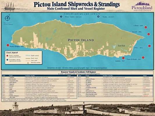
PIHS interpretive · 2026
Explore approximate maritime localities and their histories. Markers are not surveyed wreck positions.
PIHS Interpretive Maps · Explore with PIHS
PIHS · approved interpretive poster · approximate localities
Explore this map →Source reference · 2026
PIHS mapping of coastal features and local names. Contact the Society for the map and its historical context.
PIHS Interpretive Maps · Explore with PIHS
Source reference · 2026
A PIHS interpretive poster. Contact the Society about the map and available formats.
PIHS Interpretive Maps · Explore with PIHS
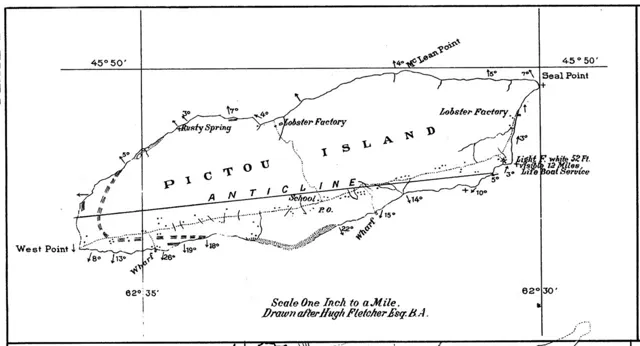
Historical original · enhanced detail · 1891
Pictou Island in 1891. Detail of Plate I accompanying A. H. MacKay’s geological study, drawn after Hugh Fletcher. The map labels historical wharves and lobster factories but does not establish the exact location of the former grindstone quarry.
Industry & Natural Resources · Explore with PIHS
A. H. MacKay (1891), Plate I drawn after Hugh Fletcher. Pixel source: Dalhousie University Libraries / DalSpace.
Explore this map →Maps through time
Start with the map’s date and purpose, then follow the corresponding period, land history and place records.
Browse the complete map inventory ↓
1834
MacKay’s Great Map places the island in its regional setting. This outline is not the missing 1830 division plan and does not locate individual households.
Nova Scotia Archives · Great Map, V123/V124 · image 201587149
View the original 1834 Pictou Island panel at Nova Scotia Archives →
1879
Meacham’s atlas records printed property names, divisions, a schoolhouse, wharf and lighthouse. Compare the names with biographies and deeds; the map alone does not prove title or resolve namesakes.
J. H. Meacham & Co. · Illustrated Historical Atlas of Pictou County · Section 19, pp. 72–73 · PIHS supplied scan
1953
The East sheet contains Pictou Island; the West sheet covers the adjacent region. These regional sheets complement the histories of roads, services and post-war change. Their scale limits building-level comparisons.
Canada, Department of Mines and Technical Surveys · NTS 11 E/15 East and West · 1:50,000 · Borealis
Follow the existing Island of Abundance research into the maps’ changing names and purposes.
c.1730s — undated manuscript · French manuscript labels “Isle de Pictou”
An undated French manuscript at the Bibliothèque nationale de France directly names the offshore “Isle de Pictou” opposite the mainland “Havre de Pictou.” It is provisionally dated to around the 1730s; whether it predates Popple’s 1733 engraving is unknown.
Read the historical context →1733 / 1746 · Popple’s “I. Cocagne” remains unresolved
Henry Popple’s regional Sheet 7 (1733, retained in a 1746 state) places “I. Cocagne” beside a small offshore feature. Pictou Island is a plausible but unproven identification; the map does not establish an alternative historical French name for the island.
Read the historical context →1757–1764 · Bellin records I. Pictou
Bellin’s map editions label I. Pictou off Nova Scotia while locating Cocagne separately. This is direct island-name evidence and constrains, but does not resolve, Popple’s earlier “I. Cocagne.”
Read the historical context →1777 · Pictou Island is stabilized in British hydrography
Des Barres clearly records Pictou Island in the Northumberland Strait survey. The chart establishes navigational-name use, not settlement.
Read the historical context →1809 · Cochrane re-grant
Pictou Island is surveyed as a discrete tract and re-granted to Sir Alexander Forrester Inglis Cochrane. The surviving draft includes quit rent, improvement alternatives and a five-year forfeiture/reversion clause. The grant establishes paper title and conditions, not permanent settlement.
Read the historical context →August 1890 field visit · published 1891
A. H. MacKay (1891), Plate I drawn after Hugh Fletcher. Pixel source: Dalhousie University Libraries / DalSpace.
A. H. MacKay, “Pictou Island,” Proceedings and Transactions of the Nova Scotian Institute of Science, 8(1), pp. 76–83, Plate I (1891).
Original 1891 work is public domain; BHL volume 8 is marked NOT_IN_COPYRIGHT. Display pixels sourced from the approved DalSpace scan.
Original paper and map at DalSpace ↗A printed boundary is not a modern cadastral survey. An illustrated locality is not a surveyed wreck position. Historic sources and modern interpretation are labelled separately; no present-day forest image reconstructs the nineteenth-century landscape.
The regional library’s plot plan accompanies memorial photographs and research. It is not a complete burial register.
Open the plot planExplore nineteen landmarks and follow their histories through original maps in the Historical Atlas.
Open the Historical MapExplore approximate maritime localities, story markers and the qualified wreck register.
Open the shipwreck mapBrowse historical map sources in Research Resources
Maps reflect their makers, dates and purposes. A historic label does not establish a present-day boundary.