
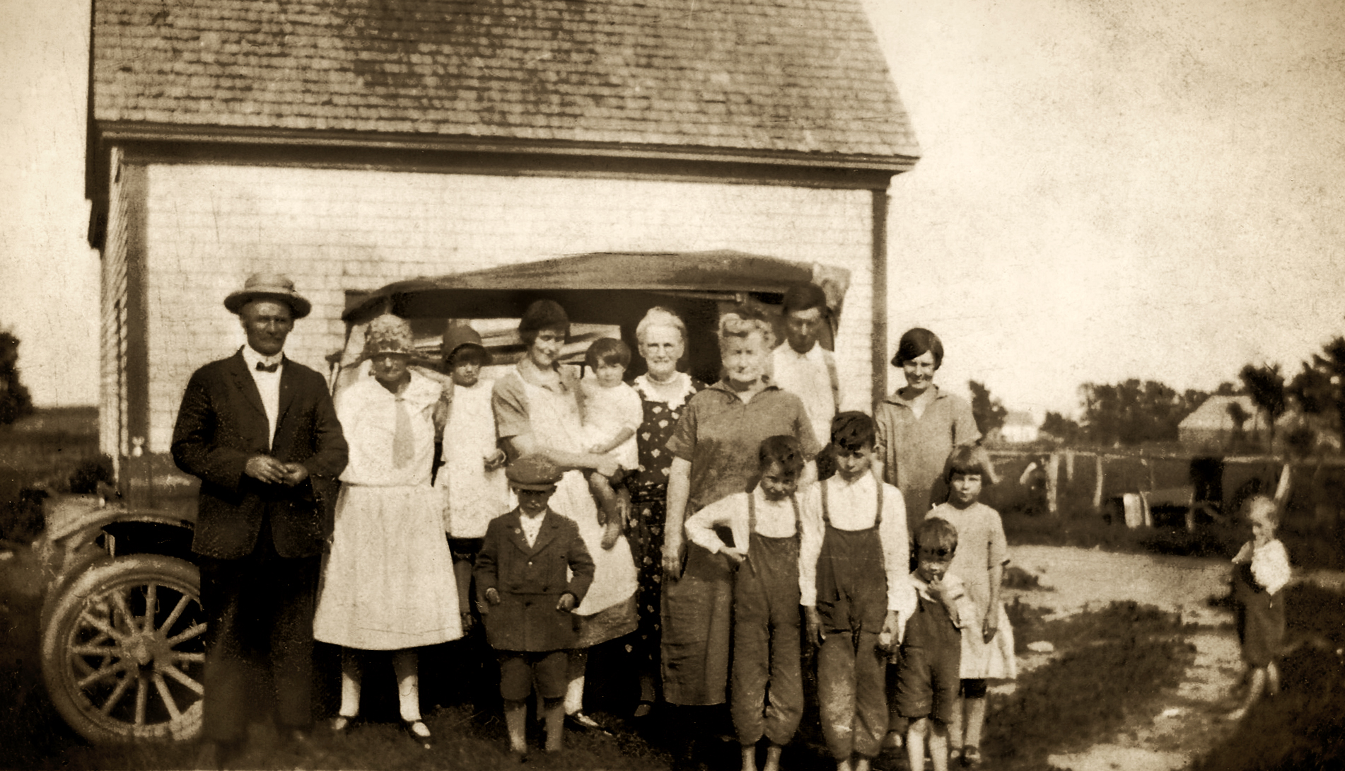

MacLean family group with a car
Pictou Island Heritage Society

PICTOU ISLAND HERITAGE SOCIETY · VIRTUAL MUSEUM

Pictou Island Through Time

Follow the island’s history across names, maps, settlement, work, community life, connection and the living island today.

Timeline context and anniversaries

Explore the Island through time

Pictou Island through the years

Explore Pictou Island's history through time, from the island's earliest recorded names and maps through settlement, community life, work and the living island today. Follow individual events into the exhibits, places and stories of the Pictou Island Virtual Museum.

November 13, 2026

This date in Island history

Discover stories from 100 and 200 years ago. Some are tied to a particular day; others belong to a year or a wider period.

100years ago

1926

We have not identified an event for this exact day in 1926.

This year · 1926

John Alexander “Jack Happy” MacDonald — fishing context

John Alexander “Jack Happy” MacDonald grew up in a large Pictou Island fishing family, the son of Angus Hector “Happy Angus” MacDonald and Adeline “Dollie” MacFarlane.

Read the related history

Across this period · 1923–1926

When the factory era ended

By the early 1920s, two factories appear to have remained: Magee’s at the East End and another near the end of Factory Road. The operator at Factory Road and the exact sequence of closures are uncertain. Lobster canning appears to have ended between 1923 and 1926; Kenneth MacCallum separately recorded the last fish packing in 1926. The East End building was unused by the early 1930s and later dismantled as erosion threatened the site.

Read the related history

200years ago

1826

We have not identified an event for this exact day in 1826.

No anniversary story is available here for 1826. Explore the Timeline below for other periods.

Search and filter the timeline

Find a moment in Island history

102 events

The page address preserves these filters. Dates and ranges retain their source qualifications.

Choose a period to open its events, or search above to reveal matching periods.

01

Before 1809 — Known, Named & Mapped

13 events

Place & history

Mi’kmaw place knowledge and Pictou Island traditions

Pictou Island lay within the wider Mi’kma’ki maritime geography associated with Epekwitk aq Piktuk. Historical and modern sources preserve Mi’kmaw names for the Island. Three later written transmissions — Patterson (1877), John Newell recorded by Wallis at Pictou Landing in 1911–12, and MacMillan/McKenzie (1924) — preserve a localized Pictou Island tradition involving passage, survival, temporary presence and marine-resource use. The versions differ and do not establish one exact event, a permanent village, fixed recurring encampment, normal season or quantified frequency of use.

Island of Abundance →

Place & history

European jurisdiction divides the Gulf region

The Treaty of Utrecht transfers Nova Scotia/Acadia to Britain while France retains Île Saint-Jean, Île Royale and other Gulf islands. Pictou Island is not individually named in the treaty.

Island of Abundance →

Maps & naming

French manuscript labels “Isle Pictou”

The anonymous Carte de l’Isle de St Jean labels an offshore island “Isle Pictou.” The Bibliothèque nationale de France holds the original (btv1b530900307); Library and Archives Canada holds photographic copy 4149490, Ph/204/[1720]. Its approximate catalogue date of [1720] has not been confirmed as the date it was drawn. Its relationship to another French manuscript map remains uncertain.

Island of Abundance →

Maps & naming

French manuscript labels “Isle de Pictou”

An undated French manuscript at the Bibliothèque nationale de France directly names the offshore “Isle de Pictou” opposite the mainland “Havre de Pictou.” It is provisionally dated to around the 1730s; whether it predates Popple’s 1733 engraving is unknown.

Island of Abundance →

Maps & naming

Popple’s “I. Cocagne” remains unresolved

Henry Popple’s 1733 map, repeated in 1746, places “I. Cocagne” beside a small offshore feature. It may represent Pictou Island, but this is unproven; the map does not establish Cocagne as another French name for the Island.

Island of Abundance →

Place & history

The Grand Dérangement reshapes the region

The forced removal of Acadians begins in mainland Nova Scotia in 1755. After the fall of Louisbourg in 1758, British forces occupy Île Saint-Jean and deport much of its Acadian population. The operation passes through regional waters near Pictou Island. The sources reviewed do not establish an Acadian settlement or deportation site on the Island itself.

Island of Abundance →

Maps & naming

Bellin records I. Pictou

Bellin’s maps label I. Pictou off Nova Scotia and show Cocagne separately. They do not settle what Popple meant by the earlier “I. Cocagne.”

Island of Abundance →

Place & history

Pictou/Malogomich Peace and Friendship Treaty

Executive Council records describe a Peace and Friendship Treaty with the Pictou/Malogomich Mi’kmaq, dated here to 12 October 1761. No signed original is known to survive. The treaty is distinct from a surrender of Pictou Island.

Island of Abundance →

Place & history

Proclamation records a Mi’kmaw claim through Piktouk

A 1762 proclamation recorded a Mi’kmaw claim through the Piktouk geography. This belongs to the Crown–Mi’kmaw treaty and land-claim history and should not be confused with later Crown paper title.

Island of Abundance →

Place & history

France’s remaining regional claims pass to Britain

The Treaty of Paris formally transfers France’s remaining imperial claims in the region to Britain. This is a France–Britain imperial transfer, not a Mi’kmaw land cession.

Island of Abundance →

Land & settlement

Crown grant includes Pictou Island

A published transcription of the 15 October 1765 Pictou grant includes Pictou Island. The original registered grant has not yet been examined.

Island of Abundance →

Land & settlement

Pictou grant escheated

The Pictou grant is reported to have returned to the Crown through escheat in 1770. The year is strongly supported, but the exact record, date and treatment of Pictou Island remain unverified.

Island of Abundance →

Place & history

Pictou Island is stabilized in British hydrography

Des Barres clearly records Pictou Island in the Northumberland Strait survey. The chart establishes navigational-name use, not settlement.

Island of Abundance →
Back to filters ↑
02

1809–1849 — Land, Tenancy & Early Community

10 events

Land & settlement

Cochrane re-grant

Pictou Island is surveyed as a separate tract and granted again to Sir Alexander Forrester Inglis Cochrane. A surviving draft sets out rent, improvements and possible forfeiture after five years. It records colonial title and conditions, not proof of permanent settlement.

Island of Abundance →

Land & settlement

Early documented family-based tenant households

Writing years later, Patterson says Cochrane’s agent William Cumming was “accompanied or soon followed” by the Boyd, Hogan and Morris families. His account was not written in 1814.

Island of Abundance →

Land & settlement

A durable Highland Scottish settlement stream develops

A longer-lasting Scottish settlement stream begins around 1819, followed by the formation of a mature community through arrivals, departures, landholding and family networks.

People and families →

Population & work

The island records 59 residents

The surviving island-level figure records 59 residents and 116 cultivated acres, providing an early measure of an organized community.

Population context →

Maritime

Asadalia is reported lost at Pictou Island

A contemporary notice reports the vessel lost at Pictou Island. Local fishermen associate the wreck with Asadalia Reef, though its precise position has not been confirmed.

Read the Asadalia story →

Land & settlement

From estate subdivision to lots offered for sale

An 1863 deed refers to a numbered division plan dated 10 May 1830. The Pictou Observer of 12 August 1834 carries a notice, dated 2 April, offering Pictou Island in 100-acre lots. The original plan has not been found, and the advertisement does not prove every lot was sold.

Island of Abundance →

Land & settlement

Transition toward resident family ownership

A division plan existed by 10 May 1830, and land was offered in lots in 1834. Neither establishes when a resident first bought land. An 1863 deed records a later property transfer.

Island of Abundance →

Maps & sources

MacKay’s Great Map records the island outline

The recovered Great Map sheet provides regional cartographic context. It is not the unrecovered 1830 lot-division plan and does not identify individual households.

Explore the dated map source →

Population & work

Seventeen households represent 119 residents

The census records 17 household heads and 119 residents, showing community growth without implying a complete genealogy.

Read the census context →

Land & settlement

Cochrane conveys an interest to John McGregor

A registered deed records Sir Thomas John Cochrane’s transfer to John McGregor, a Halifax barrister, for £400. It includes a ten-acre exception and naval and public-use reservations. It does not establish the first purchase by an Island resident or ownership of the whole Island without restrictions.

Read the land history →
Back to filters ↑
03

1850–1899 — A Growing Island

30 events

Maritime

The East Lighthouse enters the island story

The East station was nearly complete by November 1853 and an operating light is reported in the 1854 record. The precise first-light date remains distinct from the construction milestone.

Keeping the Island Lit →

Maritime

Fairy Queen is lost near Pictou Island

A mail and passenger steamer was lost near Pictou Island in severe weather; surviving accounts disagree on the casualty total.

Read the Fairy Queen story →

Land & settlement

McGregor assigns Island interests in trust

The registered assignment of 23 March 1857 transferred John McGregor’s legal and equitable interests in Pictou Island to Charles Twining, both Halifax barristers, in trust. It recites debts and advances of £250 and upwards and authorizes sales and deeds, with proceeds applied after expenses to the advances and interest. This was a security and trust transaction, not a purchase of the whole Island for £250.

Read the trust and lot evidence →

Transportation

Allan McDonald petitions for public-wharf aid

The Nova Scotia House of Assembly received Allan McDonald’s request for help building a public wharf on Pictou Island. The record does not say whether the request was approved, money was spent or the wharf was completed.

Living by the Strait →

Land & settlement

Twining conveys Lot 26 to John McFarlane

On 1 June 1858, Charles Twining conveyed eastern-end Lot 26 to John McFarlane, described as a Pictou Island yeoman. The deed describes about 100 acres on Peter Crerar’s 1830 plan and reserves the public road. Its £2 10s is the balance of consideration, not the total price. The registered deed is Book 45, page 248. It does not establish that the buyer was John D. McFarlane or prove a later 1908 estate transfer to Robert.

Read the Lot 26 deed →

Land & work

Hugh McDonald conveys the eastern half of Lot 5

The registered deed records Hugh McDonald, farmer, conveying approximately fifty acres to Robert McDonald, mariner, for $2. Its recital names Peter Crerar’s 10 May 1830 division plan; the original plan remains unrecovered. The transaction does not establish their kinship.

Read the land and farming history →

Transportation

Provincial wharf estimate proposes $100

A provincial estimate listed $100 for a Pictou Island wharf. It does not confirm that the money was paid or the work completed.

Living by the Strait →

Transportation

Provincial wharf allocation records $400

A provincial grant allocation listed $400 for the Island wharf. It does not show how much was ultimately spent or when construction was completed.

Living by the Strait →

Transportation

Provincial wharf estimate proposes $200

The provincial estimate listed a proposed $200 for the Island wharf. This was separate from the 1866 allocation and does not show what was actually spent.

Living by the Strait →

Fisheries & work

Shore-based fish processing becomes established

Lobster processing was underway on the Island in the 1870s, though the identity of its first factory remains uncertain.

The Lobster Island →

Education

An operating Island school is documented

An official education report describes the Island school closing abruptly before the summer term ended. This directly confirms operation, without establishing when the first school opened.

Schoolhouse history →

Maps & sources

Meacham’s atlas names properties and landmarks

The Pictou County atlas labels property names and divisions, a schoolhouse, wharf and lighthouse. Read it alongside deeds and biographies; printed names do not by themselves prove title or resolve namesakes.

Explore the atlas and land history →

Transportation

Federal repairs document the West Wharf

Federal records describe repairs and strengthening of the West Wharf by 1880. They show that a wharf was already there, but do not establish when it was first built or its exact location today.

Living by the Strait →

Fisheries & work

Commercial lobster fishing is firmly documented

Commercial lobster fishing formed part of the Island’s working life, alongside farming and other work.

The fishery begins →

Transportation

The East Wharf is constructed

Federal records describe construction of the East Wharf in 1882–83. Its exact location today is uncertain. It was a different structure from the later East End breakwater.

Living by the Strait →

Fisheries & land

Malcolm McDonald leases shoreline land to William F. Shedd

The lease provides a twenty-five-year term, water privileges and shore/main-road access for a south-side farm parcel. One dollar was acknowledged in full for the term. Registered in October 1887, it does not establish a modern factory footprint.

Read about the lease →

Education

A schoolhouse is constructed

Official education reports record schoolhouse construction in summer 1884 followed by winter operation, after no school was reported in the 1882 and 1883 school years. This is a construction milestone, not a proven first-school date.

Schoolhouse chronology →

Maritime

Inveralt grounds at East Point; salvage later turns fatal

The steamship grounded at East Point on 4 August 1884. During later salvage, a lifeboat carrying eleven wreckers overturned on 15 November; eight men died and Island boats answered the emergency.

Read the grounding and salvage history →

Fisheries & land

Shedd estate interests pass to James Hogg

Gould N. Brown, trustee of William F. Shedd’s estate, conveys separately described freehold, lease and West End Cove shanty interests to lobster packer James Hogg for $485. The deed does not establish one combined factory site.

Read about the conveyance →

Maritime

The Pictou Island Life-Saving Station is established

The station formalized the island's role in responding to vessels and people in danger in the surrounding waters.

Life-saving and connection →

Faith & memory

Pioneer Cemetery land deed

The deed dated 13 September and registered 3 November records a $40 transfer to cemetery trustees. About one-and-a-half acres covers the road and cemetery combined; it does not date first burials or movement of remains.

Read the deed and cemetery history →

Maps & naming

MacKay records Lobster Factory Cove

A. H. MacKay records this North Shore name in his 1891 account. Ron MacDonald identifies the historic cove as today’s John Dans Cove.

John Dans Cove history →

Fisheries & work

Bay View lobster hatchery is established

The Bay View hatchery was established in 1891. Later records connect it with lobster eggs collected from Island canneries.

Fishery history →

Maritime

Andrew MacFarlane is appointed to the East Lighthouse

Federal records date the appointment to 8 June 1892, linking lighthouse service with island family and working life.

Andrew’s biography →

Faith & memory

A cemetery public-road petition is granted

Pictou County Council granted a petition for a public road from the main road to the Island cemetery, with Alex. F. Campbell as Commissioner. This decision is separate from the 1890 deed, which describes a twenty-foot-wide public road. The council decision does not establish the modern surveyed route.

Pioneer Cemetery history →

Faith & memory

Later cemetery-road confirmation is disallowed

The January 1893 Pictou County Council proceedings record the later cemetery-road confirmation as disallowed, following the granted petition of January 1892. These are distinct municipal stages. The records do not demonstrate road construction, establish the same surveyed alignment, explain the disallowance, or revoke the access described in the separate 1890 deed.

Source ↗
Read the cemetery access history →

Fisheries & work

Federal fisheries evidence lists four site/operator entries

The return records several factory contexts and operators. It does not establish four separate companies or prove that all sites operated simultaneously.

Explore the cannery history →

Maritime

Sirius is recorded among the island's maritime casualties

The vessel belongs to the broader wreck and navigation history; it is included here as a significant maritime milestone, not as a complete casualty register.

Ships and the Strait →

Language & community

Gaelic remains visible in community records

A Gaelic reading record, Gaelic-book provenance and the 1901 census place Gaelic within island life without proving every person's fluency or daily language use.

Gaelic in community life →

Maritime

The government steamer Stanley grounds in ice

The Marine Department report records the government steamer Stanley grounding near Pictou Island in packed ice on 22 January. After its after-ballast tank was emptied, the vessel backed off without damage on 23 January. This was not the 1893 rescue of the Norwegian barque Stanley.

Source ↗
Ships and the Strait →
Back to filters ↑
04

1900–1945 — Work, Water & Connection

29 events

Transportation

Organized Island mail carriage is documented

The Postmaster General’s report lists a contracted mail route between Pictou and Pictou Island. Mail was carried on an organized route by 1902, though the year it began is not known from this record.

Living by the Strait →

Transportation

Government authorizes $800 for Island wharf work

A House of Commons reply records $800 authorized for Pictou Island wharf work. Materials were to be obtained and the work was intended before 1 July, but the reply does not confirm it was completed.

Living by the Strait →

Fisheries & work

Federal return records three Pictou Island canneries

The federal fisheries return records three Island canneries in 1903. The returns for 1906 and 1907 also record three.

Cannery history →

Transportation

Minto and Stanley are caught in Strait ice

Winter reports show how island wharves, dories, factories and local knowledge supported movement when the usual route across the Strait failed.

Frozen in the Strait →

Maritime

West and South/Wharf lights strengthen navigation

The West light enters the early twentieth-century navigation system, while the permanent South/Wharf light is operating for the opening of navigation in 1907.

Three lighthouse histories →

Transportation

The East Wharf is damaged

A federal report records damage to the East Wharf in 1906. Materials were later obtained for reconstruction, but this does not confirm the work was completed.

Living by the Strait →

Community

Comedy on the Rocks becomes a community story

Passengers from the icebound Stanley reached Pictou Island in March 1907. While marooned, Jere McAuliffe’s comedy company gave a concert in the Island post office on 4 March, described by The Moncton Transcript as the Island’s first theatrical performance.

Read Comedy on the Rocks →

Community

A snapshot of Island life

Evangeline Heartz’s contemporary account described roughly 150 people with a school, hall, post office, lobster industry, lighthouses, farms and fishing activity. The same visit became part of the story remembered as Comedy on the Rocks.

Comedy on the Rocks →

Transportation

Materials are procured for East Wharf reconstruction

A federal report records that materials were obtained for a proposed reconstruction of the East Wharf. The records do not establish that the work was completed.

Living by the Strait →

Maritime

Calluna is stranded near the East End

The casualty is retained as a significant maritime event; the exact relationship to the East End reef locality remains qualified in the detailed record.

Ships and the Strait →

Transportation

The East Wharf is reported destroyed

A later federal report says the East Wharf was destroyed by 1910. The exact date and whether the earlier proposed reconstruction was completed remain unknown.

Living by the Strait →

Faith & community

Sutherland Presbyterian Church opens

The new Island church was formally opened as part of a three-day Presbyterian observance. Following Saturday’s preparatory service, the first Sunday services on 16 October included Gaelic and English worship, communion and baptism.

The Church opening weekend →

Families & fisheries

John MacLeod’s marriage records Island lobster-packing work

John MacLeod’s marriage to Ethel A. MacKenzie identifies him as a lobster packer resident on Pictou Island and born at High Bank, PEI. It records both parental pairs, without locating a factory or proving land ownership.

Read the marriage and fishery evidence →

Transportation

Commons reply names Duncan McCallum as new coxswain

A House of Commons reply said the Island life-saving crew changed in 1912 because coxswain Alexander Currie no longer lived permanently on the Island. It named Duncan McCallum as the new coxswain, but did not give his exact appointment date.

Living by the Strait →

Transportation

West Wharf repairs account for $1,200

The Auditor General’s accounts record $1,200 spent on repairs to Pictou Island West Wharf. A neighbouring $1,000 entry refers to Picket Pier. The accounts do not give the wharf’s original construction date.

Living by the Strait →

Maritime

The Pictou Island Life-Saving Station is abolished

The station's closure marks a change in the formal rescue system, while local knowledge and island crews remained part of the surrounding maritime story.

Life-saving history →

Communication

Federal funding for telephone connection

Federal records document a $5,000 appropriation for a Pictou Island telephone cable.

From Torches to Telephones →

Transportation

West Wharf repairs account for $75

A Public Works table records $75 spent on repairs to Pictou Island West Wharf. It does not give a construction amount or the project’s dimensions.

Living by the Strait →

Communication

First telephone contact with the mainland

Ruth Munro identifies 1921 as the year of the Island’s first telephone and the beginning of mainland telephone contact, alongside the federal evidence for cable work that July.

Communications history →

Population & community

The island population reaches 228

The census records 228 residents. This count does not establish an all-time population peak.

Population change →

Communication

The submarine cable is laid

The Tyrian report records instructions on 9 July and cable laying between Pictou and Pictou Island on 10–14 July 1921. The accounts record $8,942.50 in Construction and Improvements; they do not establish exact landing points or the service-activation date.

The mainland connection →

Transportation

Island wharf repairs account for $554.12

A Public Works table records $554.12 spent on repairs to a Pictou Island wharf. It does not say whether this was the East or West Wharf, name a contractor or describe a construction project.

Living by the Strait →

Communication

Tyrian repairs the Island telephone cable

The federal Public Works report records the government cableship Tyrian arriving at Pictou Island on 10 June and completing repairs to the Island telephone cable on 16 June 1922. It does not establish the cable’s shore landing points.

Source ↗
Communications history →

Fisheries & work

The shore-based cannery era winds down

Lobster canning appears to have ended between 1923 and 1926; the last fish packing is separately recorded in 1926. Fishing continued after the factories declined.

When the factory era ended →

Communication

The government cableship returns for cable repair

The return of C.G.S. Tyrian connects the island's communications history with the practical maintenance of a submarine cable system.

Cable history →

Maritime

Edward Grover is stranded at Pictou Island

The original casualty return records Edward Grover, official 107954, at 69 register tons. A reported total financial loss does not establish physical destruction; a blank lives-lost column does not prove zero deaths. Exact site remains unfixed.

Source ↗
Read the casualty record →

Fisheries & work

Federal fisheries patrol is dispatched

The federal fisheries report dates a patrol near Pictou Island and adjacent waters to 8 October 1926. This dates the recorded patrol, without establishing the scale of illegal fishing or any individual offence.

Source ↗
Fishing and regulation →

Population & community

The official population count records 224 residents

The official 1931 population count records 224 residents. The manuscript also contains temporary non-residents, who are not included in the official population total.

Read the population history →

Transportation

An airborne wedding illustrates changing connection

The island's relationship with mainland services and travel continued to change through the interwar period, while family and community life remained island-based.

Transportation story →
Back to filters ↑
05

1946–1979 — A Changing Island

12 events

Community change

Post-war services and technologies reshape island life

Transportation, communication, schooling and fisheries changed together. No single invention or industry explains the later population decline.

School, services and change →

Transportation

Cameron MacDonald and Clara Cheverie arrive by island flight

The newlyweds' flight is dated to 28 February 1949, not 1948. It belongs to the island's growing history of air and mainland connection.

Read the connection history →

Transportation

A postal Air Stage flight serves the Island

D. S. MacNeil of Gulf Flying Service flew from New Glasgow to Pictou Island and back, carrying 57 pounds of mail to the Island and six pounds on the return. The flight shows mail was carried by air in 1949, but does not establish when regular service began or identify the aircraft.

Living by the Strait →

Transportation

Registry records Pictou Island No. 192306 built at Pictou

The federal vessel card records the Pictou Island, official number 192306, as built at Pictou in 1950. A later local account gives 1949. The builder lettering and ferry-service history remain separate questions.

Living by the Strait →

Population & community

The recorded population falls to 140

The post-war population decline affected schools, services, households and work. It was a long restructuring rather than one single event.

Population change →

Transportation

Pictou Island No. 192306 registry card names Rankin

A federal card dated 29 January 1951 records the vessel’s first Pictou registration that year and names Island fisherman Ernest Rankin as owner of all 64 shares. It does not say when ferry service began.

Living by the Strait →

Maps & sources

A topographic sheet places the island in its regional setting

The first-edition NTS 11 E/15 East sheet includes Pictou Island. Its regional scale complements the post-war history of roads and services, while limiting building-level interpretation.

Explore the topographic source →

Maritime & technology

The lighthouse system moves toward automation

The West light is reported automatic in 1962, while the East station's transition is retained with its own qualification in the detailed lighthouse history.

Automation and heritage →

Transportation

Government replies describe proposed Island dredging

The 1963 reply proposes work in fiscal 1964–65 subject to funding approval; the 1964 reply proposes departmental equipment and a start dependent on weather and other work. Neither establishes commencement, completion, expenditure or an exact location.

Read the dredging proposals →

Education

Regular public-school classes end

The school history distinguishes the end of regular classes in 1971 from the broader education transition that continued into 1972.

School and community →

Transportation

Pictou Island vessel shares change hands

The vessel card records a bill of sale dated 1 March 1974, registered on 4 April, transferring all 64 shares to a new owner. These dates do not establish when a ferry route or service changed.

Living by the Strait →

Population & community

The recorded population reaches 37

The figure marks the depth of post-war contraction, not the end of the island community. Later residence, return, fishing and seasonal connection continued.

A smaller community →
Back to filters ↑
06

1980–1999 — Transition & Continuity

2 events

Community change

Seasonal connection and year-round continuity coexist

Family homes, return visits, fishing ties and changing work patterns kept the island connected even as the permanent population became smaller.

Seasonal homes and continuity →

Faith & memory

Heritage places and family collections preserve island memory

Photographs, buildings, cemeteries, oral histories and surviving objects increasingly carry the work of documenting a changing community.

Faith, Death & Memory →
Back to filters ↑
07

2000–Today — The Living Island

6 events

Living island

The island remains a living community

Pictou Island continues through permanent residents, seasonal families, fishers, visitors, descendants, community work and stewardship.

A community changed, not gone →

Transportation

Harbour wharf and breakwater replacement is completed

The DFO fiscal 2003–04 report records completion of the Pictou Island Harbour wharf and breakwater replacement. Its 5,088 m² figure describes seabed habitat loss, not a structure footprint.

Source ↗
Harbour and transport history →

Heritage & stewardship

The South/Wharf Lighthouse receives heritage recognition

The surviving tower's heritage status preserves a public connection to the island's navigation history even as its navigational service changes.

Lighthouse heritage →

Transportation

West Harbour cribwork construction is documented

The construction-inspection record documents West Harbour cribwork construction in 2019; it does not independently establish the project’s completion.

Source ↗
Harbour and transport history →

Fisheries & work

The traditional buying-smack service ends

Local accounts identify 2024 as the end of the traditional buying-smack service at the Pictou Island wharf.

Fishing after the canneries →

Heritage & stewardship

The South/Wharf light's listed navigational service ends

The listed navigational service ends, while the tower remains a heritage place and part of the island's public memory.

Keeping the Island Lit →
Back to filters ↑